We invite you to attend “Art Against Artillery: Cultural Resilience in Times of War,” a panel discussion.
Date: December 4, 2025
Time: 10 am PST (8 pm Kyiv Time)
Registration: https://tinyurl.com/artagainstartillery
Organizer: Dr. Liladhar R. Pendse, Librarian for Slavic, East European, and Eurasian Studies
The event is free and open to all, provided prior registration is completed. Please sign in to your individual Zoom account and then register. All are welcome!
As the war in Ukraine is now in its third year of current military conflict (excluding the takeover of Crimea), it becomes vital for us to provide resources to our students related to the actual war and its progress. For this reason, I wanted to focus on two different platforms that currently offer updates from the field as it evolves on the ground. I hope that the readers of these maps will find them helpful to make their own assessment of the current state of affairs. The first resource is the Deepstate map.
The interface is pretty intuitive, and the map can be displayed in both English and Ukrainian legends. Below is the screenshot that shows the map as of 11:05 am PST on August 25, 2025.
The deepstate live has several different partners that sponsor the project. One of them is Brave1.
Also, there is a blog that is associated with DeepState Live, which can be accessed here.
The second source is hosted by the Institute for the Study of War, which can be accessed here. The resource provides an assessment of the Russian offensive in Ukraine with a cutoff date of August 24, 2025.
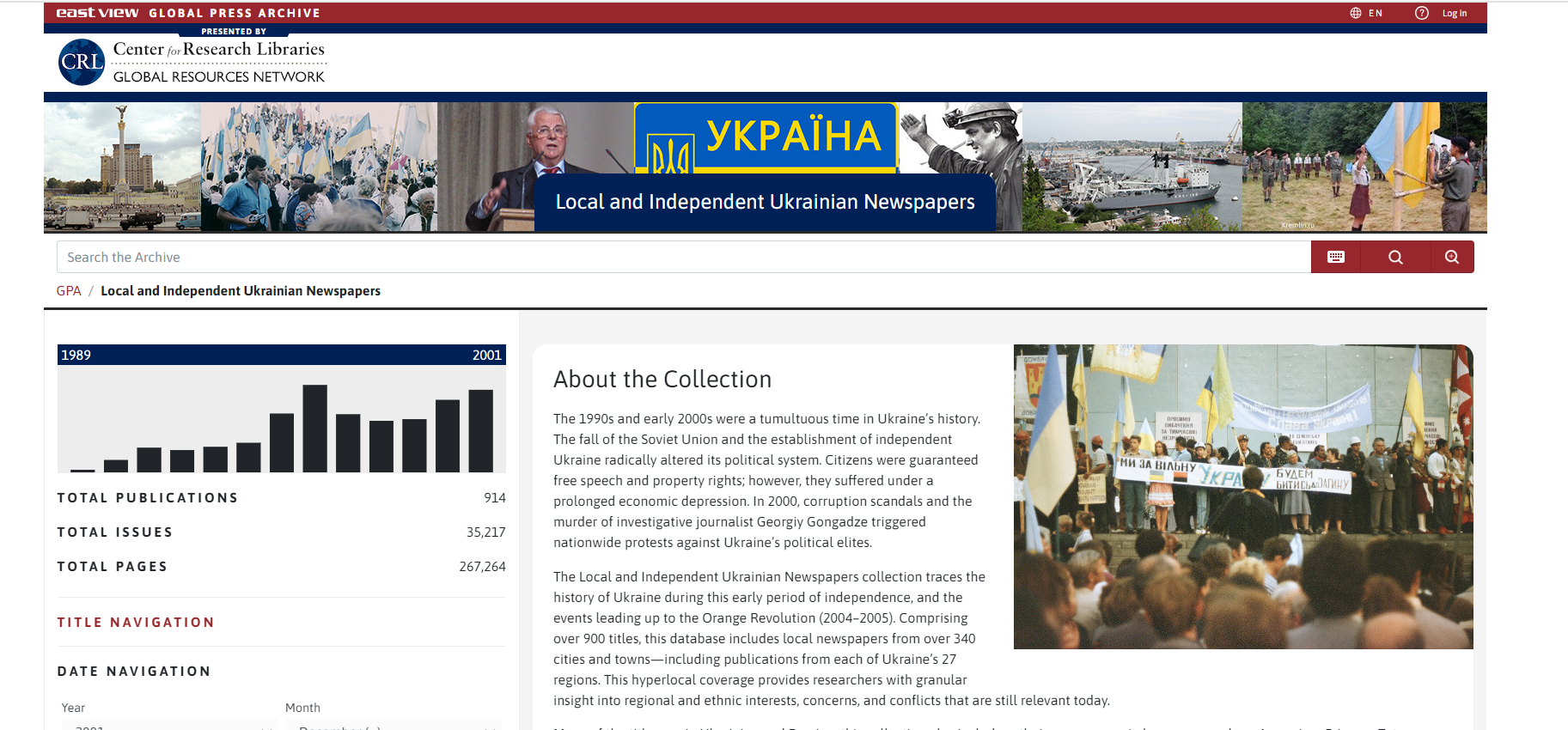
The 1990s and early 2000s marked a turbulent period in Ukraine’s history due to the fall of the Soviet Union and the emergence of an independent Ukraine. Despite gaining free speech and property rights, citizens faced economic hardships. Corruption scandals and the murder of journalist Georgiy Gongadze in 2000 sparked nationwide protests against the political elite. The Local and Independent Ukrainian Newspapers collection covers this era up to the Orange Revolution (2004–2005), offering insights from over 900 newspapers across 340 cities, reflecting regional and ethnic dynamics. The collection includes publications in Ukrainian, Russian, and other languages like Armenian, German, Polish, etc., providing a detailed view of historical events. Access to this database is supported by the Center for Research Libraries and its members.
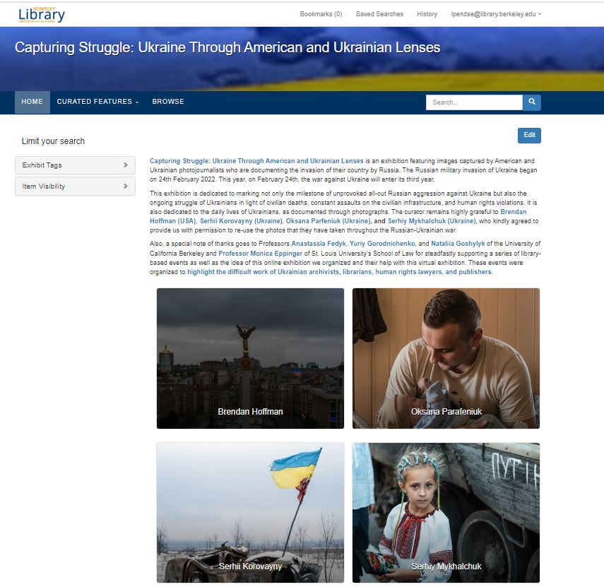
Introducing “Capturing Struggle: Ukraine Through American and Ukrainian Lenses,” an exhibition dedicated to documenting the invasion of Ukraine by Russia. This online exhibition features powerful images captured by American and Ukrainian photojournalists, marking the third year of the war against Ukraine, which began on February 24, 2022.
The exhibition not only commemorates the unprovoked Russian aggression but also sheds light on the ongoing struggle of Ukrainians amidst civilian deaths, assaults on infrastructure, and human rights violations. It offers a glimpse into the daily lives of Ukrainians through compelling photographs. We are grateful to Brendan Hoffman (USA), Serhii Korovayny, Oksana Parfeniuk, and Serhiy Mykhalchuk (Ukraine) for generously allowing us to showcase their impactful work. Also, We want to thank Svidok and AI for Good Foundation for helping us with additional photos.
Special thanks to Professors Anastassia Fedyk, Yuriy Gorodnichenko, and Nataliia Goshylyk of the University of California Berkeley, and Professor Monica Eppinger of St. Louis University’s School of Law for their unwavering support in organizing this online exhibition and related events. These events aim to highlight the resilience of Ukrainian archivists, librarians, human rights lawyers, and publishers. We also have featured recommended readings from UC Berkeley Library’s collections based on the faculty input (In English, In Ukrainian).
The idea for bringing this exhibition to the library originated at Fulbright Ukraine and Institute of International Education Kyiv, of which the Director of both these institutions, Dr. Jessica Zychowicz, is a UC Berkeley Alumna (English, ’04). Deputy Director Inna Barysh, Communications Officer Marian Luniv, and Program Officer Mariia Kravchenko envisioned the first exhibit which took place in Vynnitsia, Ukraine, and continue to co-curate all iterations. The photographs provided by Serhii Korovayny and Serihy M. were not part of the original Fullbright exhibition and were a later curatorial addition. Fulbright Ukraine has held exhibitions at several U.S. and European universities and museums, including in locations in Berlin, Czech Republic, and Bulgaria attended by U.S. Ambassadors.
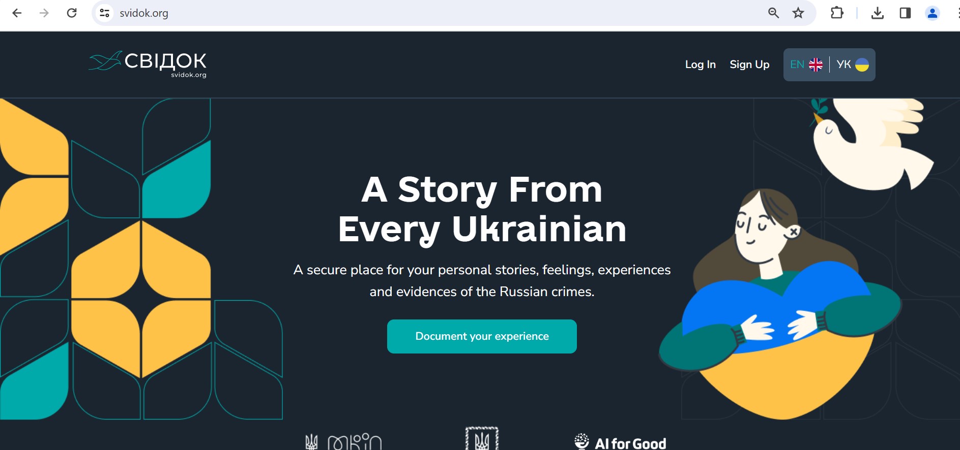
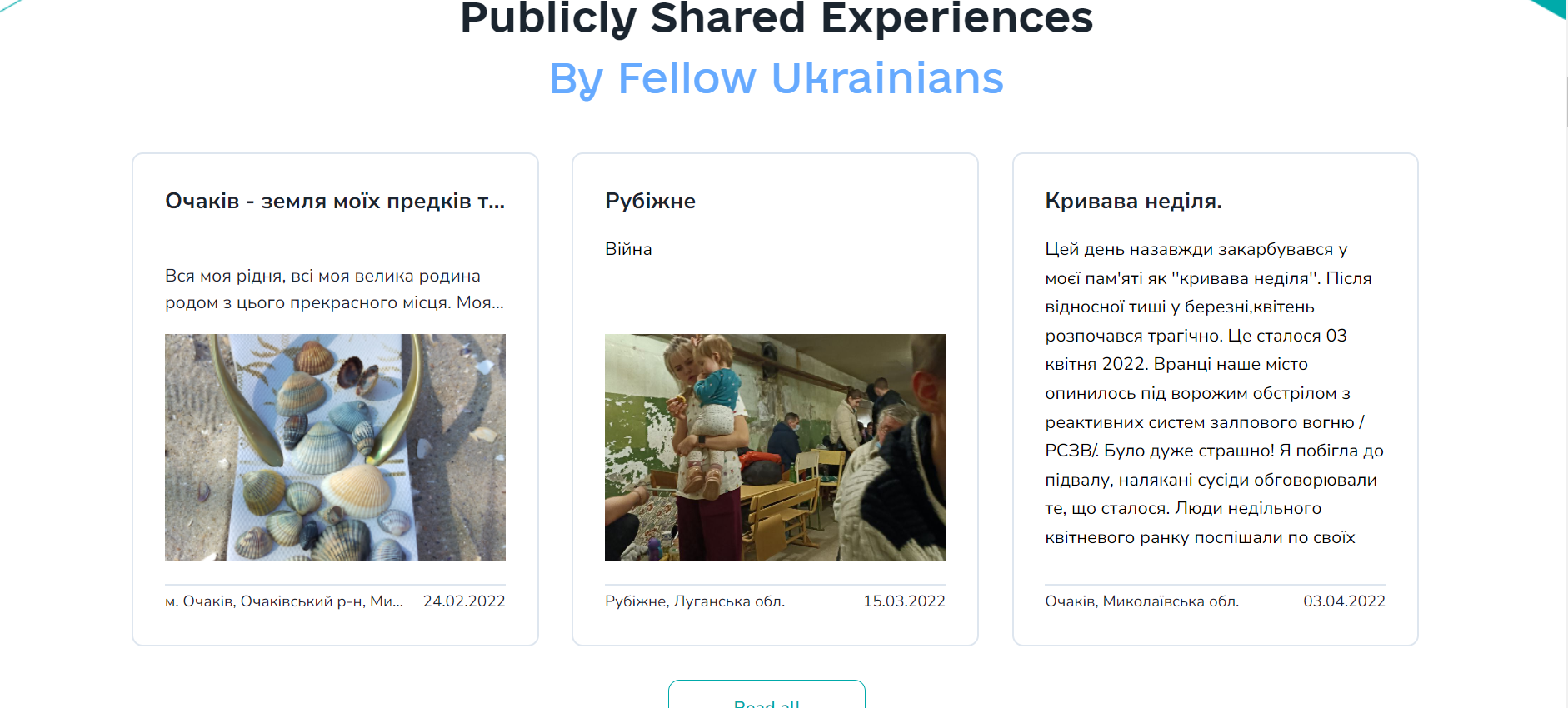
As the Russian invasion of Ukraine continues without a meaningful resolution in sight, Ukrainians continue to document the stories of Russian aggression in their country. One such project is Svidok. Svidok (свідок) means witness. The bilingual multimedia website allows Ukrainians to record their stories associated with Russian aggression. The purpose of recording is not only documenting their everyday lives but also to bear witness to history as it unfolds in their independent nation-state.
Svidok is your personal war journal. Where you can safely and securely store your experiences of living through the Russian invasion of Ukraine, and collect evidence of all the atrocities and war crimes that were committed by the Russians.
Svidok has been built by Ukraine’s proud citizens and friends in partnership with the AI for Good Foundation to ensure the truth of this war is accurately documented.
Про Свідок
Свідок – це ваш особистий щоденник війни. Ви можете безпечно та надійно зберігати свій досвід життя під час російського вторгнення в Україну та збирати докази всіх звірств та військових злочинів, які були скоєні росіянами.
Свідок був створений щирими громадянами та друзями України у партнерстві з Фундацією AI for Good, щоб гарантувати, що правда цієї війни буде точно задокументована.
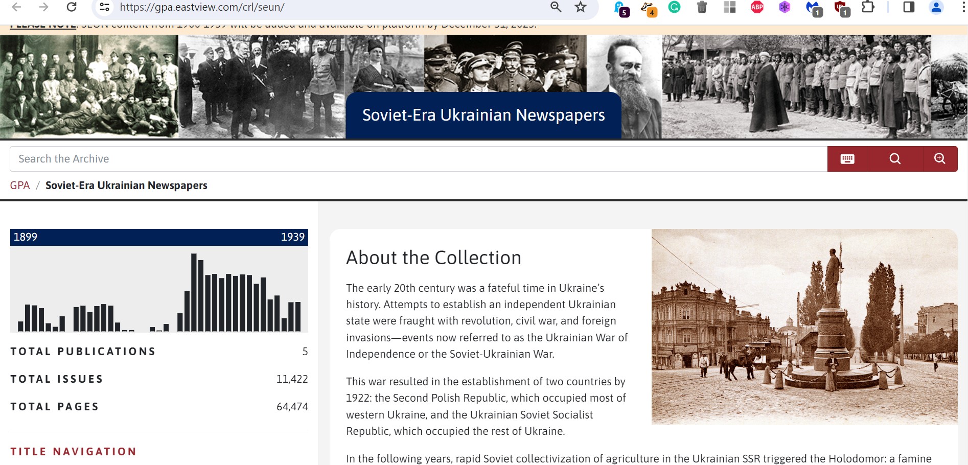
Center for Research Libraries in collaboration with the Global Press Archive of East View has released its latest digital collection of select Soviet-Era Ukrainian Newspaper. The collection can be accessed here: https://gpa.eastview.com/crl/seun/ or here
Soviet Era Ukrainian Newspaper project’s landing page. These are digital copies.
About the collection:
The early 20th century was a crucial time in Ukraine’s history, marked by attempts to establish an independent state, leading to the Ukrainian War of Independence. This conflict resulted in the creation of two countries by 1922: the Second Polish Republic in western Ukraine and the Ukrainian Soviet Socialist Republic in the rest of the country.
Following this, rapid Soviet collectivization in the Ukrainian SSR triggered the Holodomor, a famine that began in 1932 and claimed millions of lives.
The Soviet-Era Ukrainian Newspapers (SEUN) collection, with over 50,000 pages and five titles, documents Ukraine’s history during this turbulent period, including events leading up to WWII. It includes newspapers from Kyiv, Kharkiv, and Lviv, featuring content in both Ukrainian and Russian.
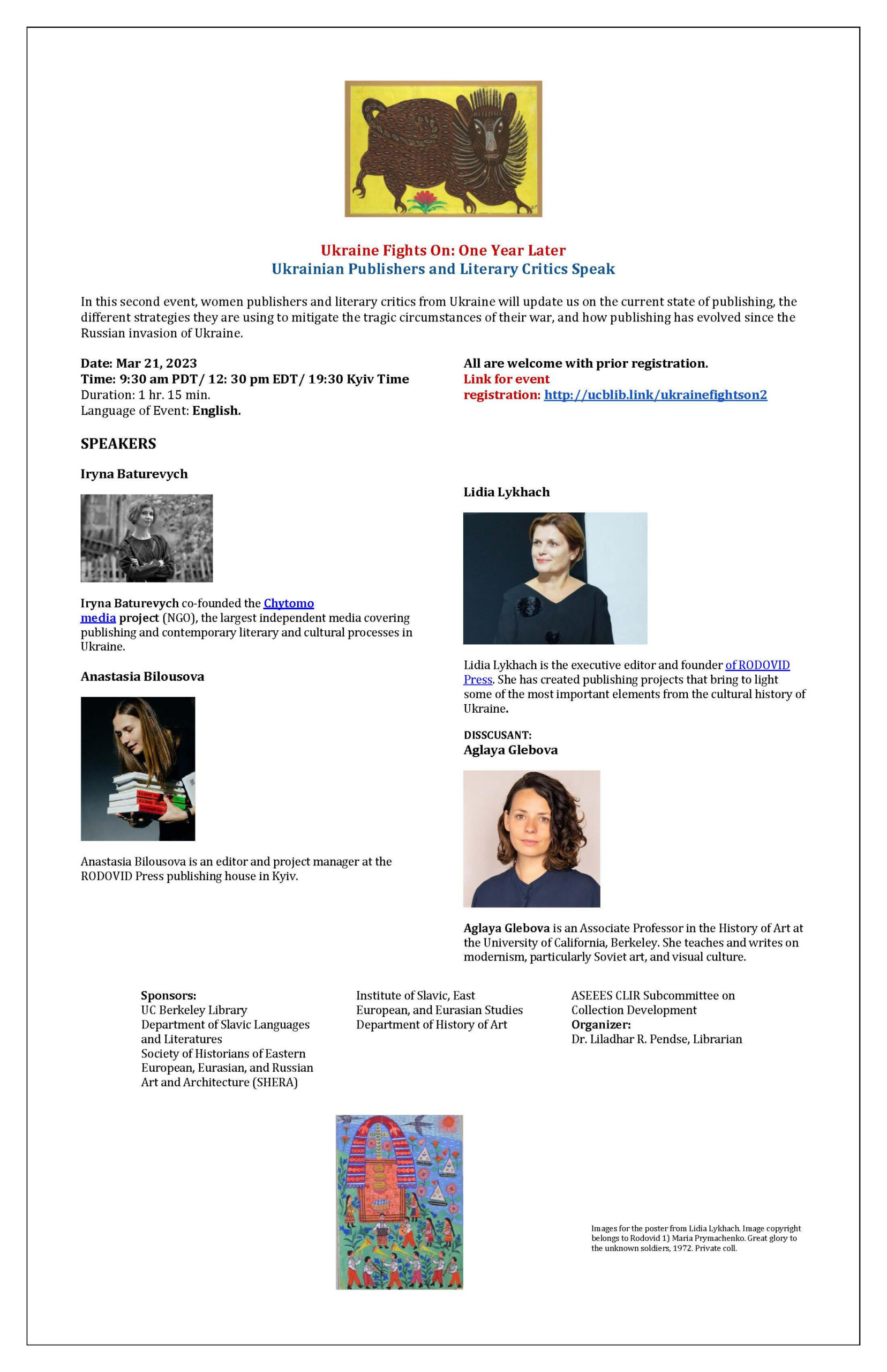
Ukraine Fights On: One Year Later Ukrainian Publishers and Literary Critics Speak
In this second event, womenpublishers and literary critics from Ukraine will update us on the current state of publishing, the different strategies they are using to mitigate the tragic circumstances of their war, and how publishing has evolved since the Russian invasion of Ukraine.
Iryna Baturevych co-founded the Chytomo media project (NGO), the largest independent media covering publishing and contemporary literary and cultural processes in Ukraine.
Anastasia Bilousova is an editor and project manager at the RODOVID Press publishing house in Kyiv.
Lidia Lykhach is the executive editor and founder of RODOVID Press.
Discussant
Aglaya Glebova is an Associate Professor in the History of Art at the University of California, Berkeley.
Organizer: Dr. Liladhar R. Pendse, Librarian for Slavic, East European, and Eurasian Studies
In the 16th century, Western European Renaissance cartographers treated the Ukrainian lands as a peripheral place. Initially, Ukraine’s territory appeared only on maps that covered much larger geographical frames, such as Central Europe, Eastern Europe, or the Black Sea region. These early maps still privileged classical sources which had provided descriptions of the area, notably Herodotus, who had authored a detailed account of the Scythian lands north of the Black Sea. Other classical authors, including Ptolemy, Strabo, Pliny the Elder, and Tacitus, covered a later period when the Sarmatians, a confederation of Eastern Iranian nomadic peoples, moved westward and, by 200 BCE, began to dominate the Scythians. Their control of the Pontic Steppe brought the Sarmatians into contact with Greek and Roman communities.
In 1477, Dominicus de Lapis published the first illustrated edition of Ptolemy’s Geography, translated by the humanist Giacomo d’Angelo da Scarperia, in Bologna, Italy. Its 26 plates, which had been engraved by Taddeo Crevilli of Ferrara, included the map “European Sarmatia,” the first printed map to cover Ukrainian territory. The prestige of Ptolemy’s Geography meant that the sheets showing “European Sarmatia” and “Asian Sarmatia” continued to be standard fare for some time.
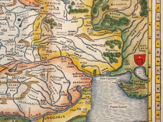
Sebastian Münster (1489-1552), Lutheran theologian, Hebrew scholar, mathematician, cartographer, and cosmographer, published four editions of Ptolemy’s Geography in his lifetime. His Geographia universalis vetus et nova (1540), printed in Basel, Switzerland, included “Tabula Europae VIII,” a map of Eastern Europe in trapezoidal form with pictorial relief, essentially Münster’s version of the sheet “European Sarmatia.” All geographical names on this map are drawn from the classical sources which Renaissance scholars prized. Rivers which dissect the Ukrainian lands are thus identified as Tyras (Dniester), Hypanis (southern Bug), Borysthenes (Dnipro or Dnieper), and Tanais (Don).
However, Münster’s 1540 edition of Ptolemy’s Geography did not contain just the Ptolemaic maps. It also featured 21 modern maps, which Münster himself had produced. Münster subsequently added new plates each time he issued a revised edition of his Geographia universalis. The 1552 edition also featured a contemporary map of Poland and Hungary, “Polonia et Ungaria, XX Nova Tabula,” based on information gleaned from the work of the Polish cartographer Bernard Wapowski (ca. 1450-1535). The Ukrainian lands west of the Dnipro (or Dnieper) River are here identified with regional labels as Russia, Volhinia, Podolia, Codimia, and Bessarabia.
Münster uses the geographical name Russia to identify the westernmost part of Ukraine, the lands of the Ruthenian domain of the Polish Crown, the Ruthenian Voivodeship. Historically this area was part of the territory of the Principality of Galicia-Volhynia (1199-1253) of the Kyivan Rus, and later the historic core of its successor, the Kingdom of Ruthenia (1253-1349). It was subsequently conquered by Lithuanians and Poles. Other Ukrainian lands west of the Dnipro River with Kyovia (= Kyiv) are shown as parts of Lithuania, within its yellow border. By contrast, the lands east of the Dnipro River are identified as Tartaria Precopien (Crimea) and Tartaria Minor, regions controlled by the Crimean Tatars. Moscovia appears in the upper eastern margin of the map, within the green border which demarcates the Tatar sphere of influence. It is shown as a territory which historically paid tribute to the Golden Horde.
The western Ukrainian cities of Leopol (Lviv) and Halitz (Halicz), important medieval centers, are shown in the left margin next to the geographical name Russia. Münster‘s Polonia et Ungaria, XX Nova Tabula thus identifies Russia as the territory of the Kingdom of Poland’s Ruthenian Voivodeship, which existed from 1434 to 1772.
In the right margin appears the emblem of the Golden Horde (also known as Ulug Ulus, literally “Great State” in Turkic), initially the northwestern part of the Mongol Empire, later transformed into a Turkicized khanate. In the 16th century “Tartaria” was controlled by the Crimean Khanate, a successor state of the Golden Horde. This is also a device that enbles Münster to show that the Ukrainian lands were contested borderlands.
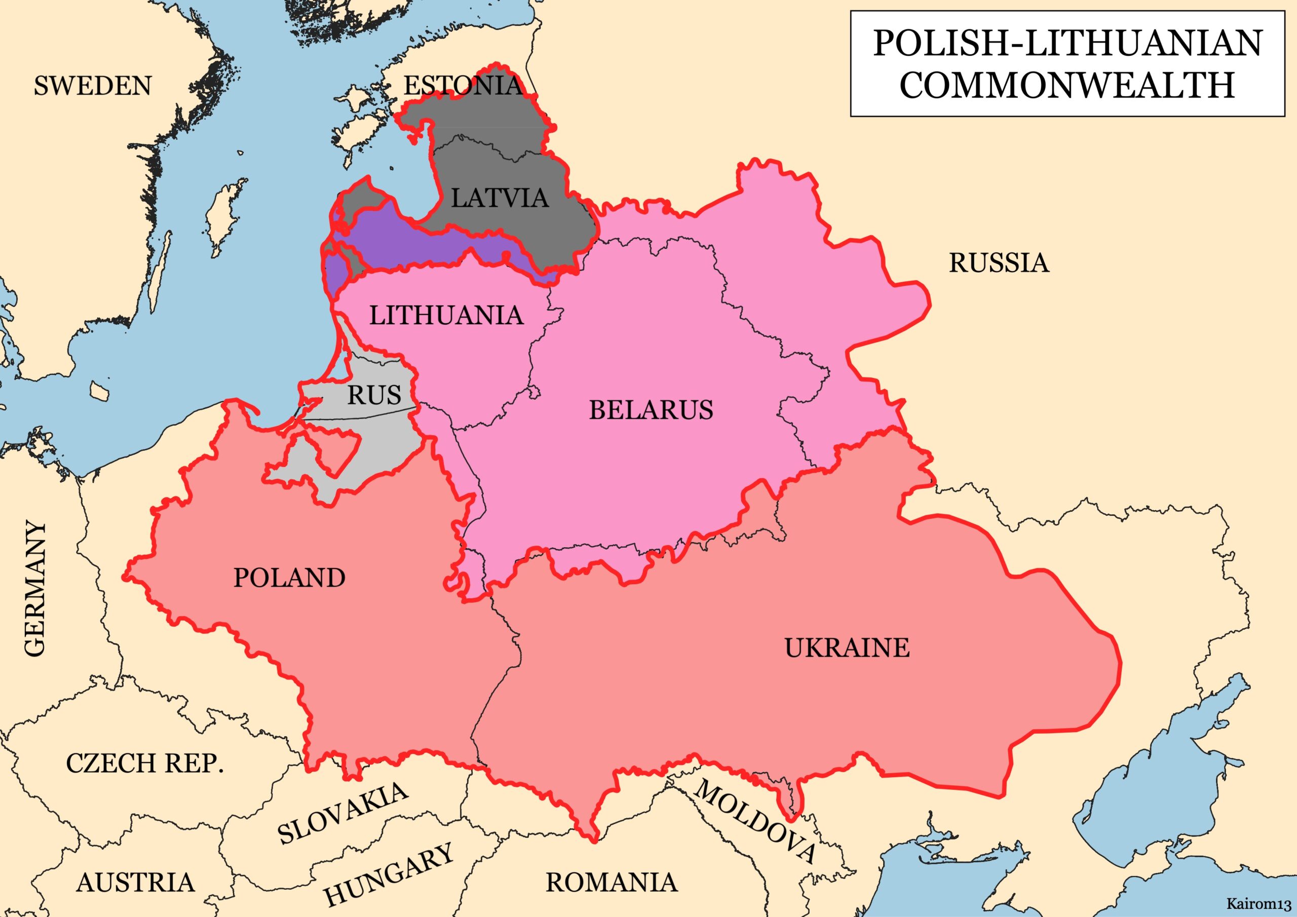
In 1618, after the Truce of Deulino, most Ukrainian lands were situated within the Polish-Lithuanian Commonwealth, but social and political crises gradually eroded its power base. Other powers tried to assert control over parts of the borderlands, including Czarist Russia, the Austrian Habsburgs and the Kingdom of Hungary, the Ottoman Empire, and the Crimean Khanate. Cossack hosts, self-governing groups of Eastern Slavic Orthodox believers, communities with military forces, grew in size, and more aggressively pursued their own interests, notably the Zaporozhian Cossacks, who established the Cossack Hetmanate.
The major subdivisions of the Polish-Lithuanian Commonwealth after the Truce of Deulino, 1618, superimposed on present-day national borders. Shown are the Kingdom of Poland, the Grand Duchy of Lithuania, the Duchy of Livonia, the Duchy of Prussia, and the Duchy of Courland and Semigallia. Image source: Wikipedia.
In 1613, the geographical name “Ukraina” appeared for the first time on a printed map, Magni Ducatus Lithuaniae, caeterarumque regionum illi adiacentium exacta descriptio, in English translation The Grand Duchy of Lithuania and the Surrounding Regions with Their Exact Description. This celebrated wall map, commonly identified as the Radziwiłł (or Radvila) map, has a complicated publication history: About 1585 Prince Mikołaj Krzysztof Radziwiłł (1549–1616), also known as Mykalojus Kristupas Radvila, a powerful Lithuanian magnate, commissioned Maciej Strubicz (1530-1604), a notable Polish cartographer, to produce a map of the entire Lithuanian state. Radziwiłł saw a need for an accurate map, which could be used as an efficient planning tool for administrative and military matters. He was also interested in documenting the boundaries and heritage of the old Lithuania, which had been obliterated by the Union of Lublin (1569). The Union’s political settlement had created a single state, the Polish-Lithuanian Commonwealth, both politically and culturally dominated by its Polish core.
Strubicz had served as secretary and geographer to Stephen Báthory, King of Poland and Grand Duke of Lithuania. He had drawn an important military campaign map, which aided Polish and Lithuanian forces in the final stages of the Livonian War (1577-1582), when they faced off against the Muscovite army of Ivan IV “the Terrible.” Báthory managed to force a settlement which excluded the Grand Duchy of Moscow from access to the Baltic Sea. For his services, Strubicz was subsequently ennobled in Warsaw in 1583. This map covered Livonia, as well as parts of the Grand Duchy of Lithuania and the Grand Duchy of Moscow. An improved version was published in Cologne, Germany, in 1589, by Marcin Kromer under the title Magni Ducatus Lithuaniae, Livoniae et Moscoviae descriptio.
Radziwiłł, who was nicknamed “Sierotka” [the orphan] to distinguish him from other members of the princely Radziwiłł family, served as Great Marshal of Lithuania (1579–1586) and Voivode of Trakai-Vilnius (1604–1616). He was a powerful man with connections and considerable means at his disposal. For years, he funded Strubicz’s work and provided support from others who gathered at Nesvizh Castle, the residential estate of the Radziwiłł family, today located in Niasviž, Belarus.
Strubciz’s diligent efforts greatly improved the mapping of this large section of Eastern Europe. He skillfully mined data derived from inventories, surveys, and terrain measurements. Many of these sources were produced during the Volok reform, a 16th-century land reform which led to an increase in crop yields and state revenue. The Volok reform strengthened the manorial system in Lithuania, but the reforms also reduced many Lithuanian peasants to serfdom. Land holdings were measured, divided into voloks, land units of about 52.8 acres, and entered into a cadaster, a detailed, official record of real estate boundaries, ownerships, and land values of a specific area.
Roaming bands of Cossacks and Crimean Tatars are shown at the bottom of the Radziwiłł map of 1613, facing off against each other in the “deserted plains.” Historians like Bohdan S. Kordan, Steven Seegel, and Serhii Plokhy have long emphasized the central role Cossacks played in popularizing the geographical name Ukraine in the 17th century. Europeans identfied Ukraine as the “Land of the Cossacks.”
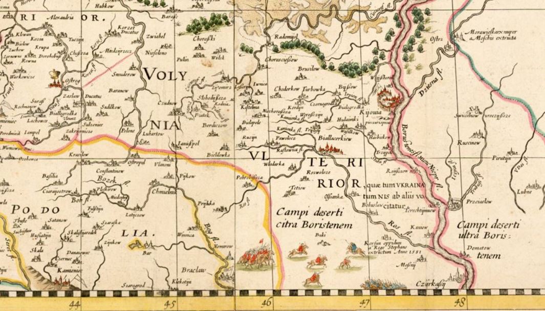
The map covers a vast region, stretching from Riga to Smolensk in the north, and from Cracow to Kyiv in the south. It locates 1,020 cities, towns, and villages, and very precisely maps water features throughout this vast region. It shows political and administrative boundaries, including a line which divides the ancient Grand Duchy of Lithuania in half and closely mirrors the present-day Ukrainian-Belarusian border. The region west of Kiova (Kyiv) is identified as “Volynia Ulterior, quae tum Ukraina tum Nis ab aliis volcitatur,” in English translation “Outer Volhynia, known either as Ukraine or as the Dnipro River Region.” The geographical name “Ukraina” thus describes part of the lands in the south, centered on the right bank of the Dnipro River. “Ukraina” roughly extends from Kyiv in the north to Cherkasy in the south. Strubicz identifies an area west of Cherkasy as wild steppe, “Campi deserti citra Boristenem,” in English translation “Deserted plains on this side of the river Borysthenes.”
Also included are historical notes and explanatory text, compiled by Tomasz Makowski (1575–circa 1630), a printer, artist, and engraver, who worked at the court of Prince Radziwiłł at Nesvizh Castle and also played an important role in preparing the map for publication. The English Jesuit mathematician Jacob Bosgrave was also a contributor. The Voivode of Kyiv, the Ruthenian Orthodox magnate Konstanty Wasyl Ostrogski (also known as Prince Kostiantyn Vasyl Ostrozkyi) and Józef Wereszczyński, Catholic bishop of Kyiv, provided cartographic data about the Ukrainian lands.
Prince Radziwiłł now contacted the Dutch map publisher Willem Janszoon (Blaeu) (1571–1638), famous for the manufacture of globes and wall maps, for publication of his map. Hessel Gerritsz (1581–1632), a Dutch cartographer of Blaeu’s publishing house in Amsterdam, engraved the plates, and, in 1613, Blaeu published the wall map in four sheets, under the imprint “Guilhelmus Janssonius.” He also published a related strip map of Ukraine’s Dnipro River region from Cherkasy to its Black Sea estuary on two additional sheets. Following the course of the river, the map describes the Dnipro rapids, local salt mines, towns and villages, and fortifications, and also includes notes about Cossack traditions. Blaeu eventually emerged as a noted publisher of atlases, and featured the Radziwiłł map in his Appendix Theatri A. Ortelii et Atlantis G. Mercatoris, continens tabulas geographicas diversarum Orbis regionum, nunc primum editas cum descriptionibus in 1631. The map subsequently appeared in other atlas editions through 1670.
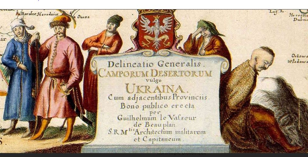
One cartographer who recognized the significance of the Radziwiłł map was Guillaume le Vasseur de Beauplan (1600-1673), a French military engineer, who served for two decades in the army of the Polish-Lithuanian Commonwealth, starting in 1630. Beauplan was initially charged with identifying suitable sites for the construction of fortifications in Ukraine. Later he planned settlements, and built or enlarged fortresses. Beginning in 1648, Beauplan turned his attention to the map trade. He published a general map of Ukraine, in 1650 followed by a special map of the same area on eight sheets, engraved in the workshop of the Dutch cartographer and map publisher Willem Hondius (de Hondt) in Gdansk.
In 1660, the Carte d’Ukranie, contenant plusieurs provinces comprises entre les confins de Moscovie et les limittes de Transilvanie, a Beauplan map published in Rouen, France, by Jacques Cailloue, boldly demarcated the boundaries of Ukraine. That same year Cailloue also published a second, enlarged edition of Beauplan’s popular Description d’Ukranie (Rouen, 1660). A third edition followed in 1661. In his writings and on his maps Beauplan carefully noted the geographical naming practices of the inhabitants of the Ukrainian lands. His decision to identify the vast region located between Transylvania and Muscovy as Ukraine reflects 17th century Cossack usage.
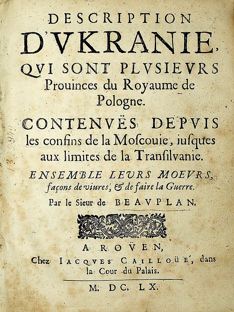
Title page of the 1660 edition of Beauplan’s Description d’Ukraniewhich provides information on many topics: Cossacks, Crimean Tatars, Polish nobles, serfdom, the country’s flora and fauna, its topography, religious and ethnic customs, governmental institutions, and many of Ukraine’s cities and towns. Image source: Wikipedia.
Beauplan’s maps were subsequently incorporated in Blaeu’s Atlas major (1659-72) and appeared in the 1680s in influential atlases published by Johannes Janssonius and Moses Pitt. Other cartographers now treated Beauplan’s work in Eastern Europe as authoritative, and continued to see Ukraine as “Land of the Cossacks.” For the next century and a half cartographers faithfully reproduced Beauplan’s maps in atlas compilations. Beauplan thus played a crucial role in helping to codify the usage of the geographical name “Ukraine,” for a large defined territory.
Suggested readings:
Buczek, Karol. The History of Polish Cartography from the 15th to the 18th Century. 2nd edition. Amsterdam: Meridian Publishing Company, 1982.
Kordan, Bohdan S. Land of the Cossacks: Antiquarian Maps of Ukraine. Winnipeg: Ukrainian Cultural and Educational Centre, 1987.
Kordan, Bohdan S. The Mapping of Ukraine: European Cartography and Maps of Early Modern Ukraine, 1550-1779. New York: The Ukrainian Museum, 2008.
Magocsi, Paul R. Historical Atlas of Central Europe. 3rd edition. Toronto: University of Toronto Press, 2018.
Plokhy, Serhii. The Gates of Europe: A History of Ukraine. Revised edition. New York: Basic Books, 2021.
Plokhy, Serhii. “Placing Ukraine on the Map of Europe.” In The Frontline: Essays on Ukraine’s Past and Present, 15-36. Cambridge, MA: Harvard Ukrainian Research Institute, 2021.
Seegel, Steven. Ukraine under Western Eyes: The Bohdan and Neonila Krawciw Ucrainica Map Collection. Cambridge, MA: Harvard Ukrainian Research Institute, 2011.
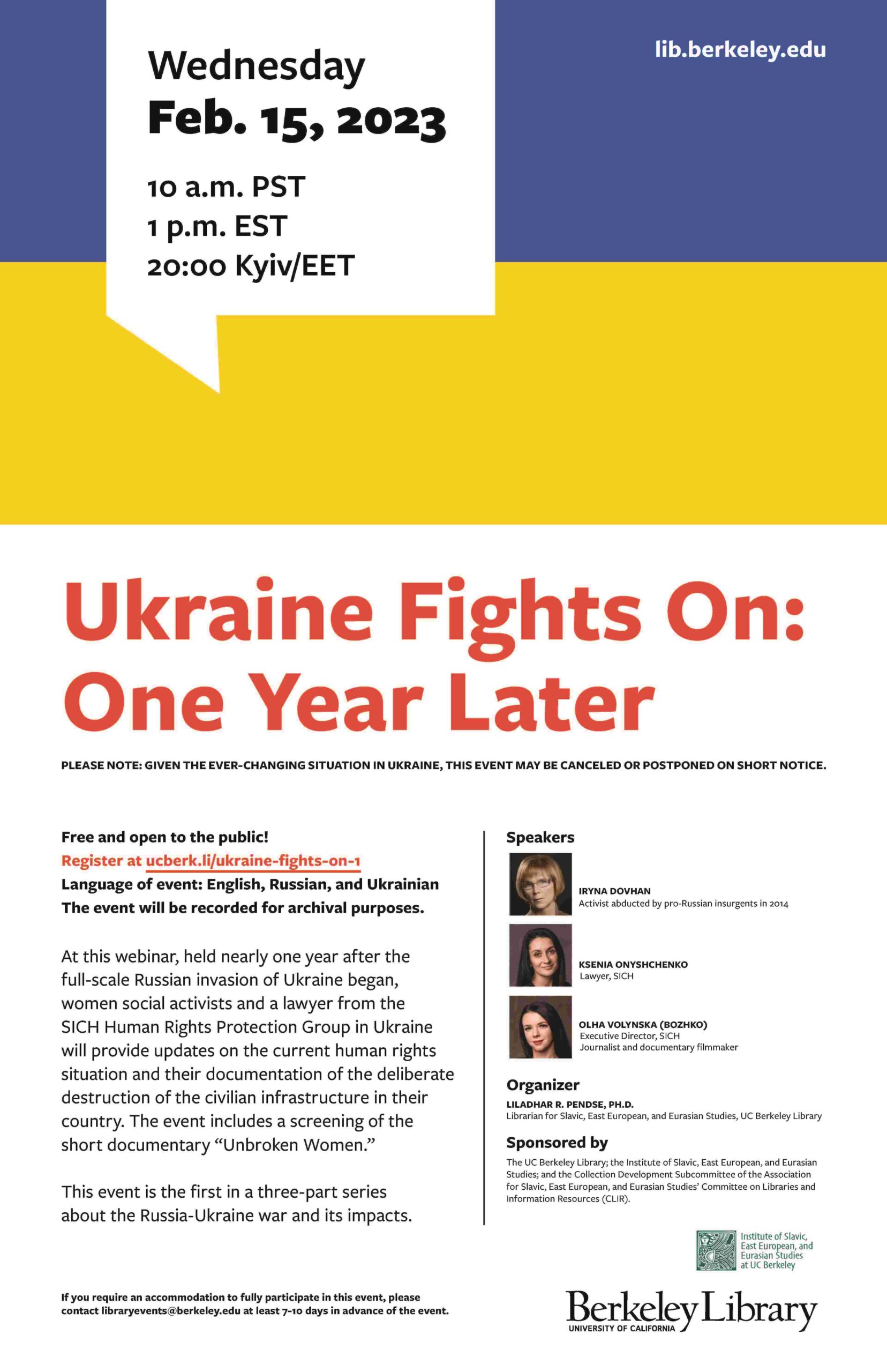
On behalf of the collection development subcommittee of the CLIR-ASEEES and UC Berkeley Library, I would like to invite you to attend the first virtual event in the three-part series of events on Ukraine that we have organized for this year. The first webinar will take place on February 15th at 10 am PST/ 1 pm EST for 60 minutes.
Note: Given the ever-changing situation in Ukraine, this event may be canceled or postponed on short notice.
At this webinar, held nearly one year after the full-scale Russian invasion of Ukraine began, women social activists and a lawyer from the SICH Human Rights Protection Group in Ukraine will provide updates on the current human rights situation and their documentation of the deliberate destruction of the civilian infrastructure in their country. The event includes a screening of the short documentary “Unbroken Women.” This event is the first in a three-part series about the Russia-Ukraine war and its impacts.
The event will be recorded for archival purposes.
Sponsored by the UC Berkeley Library; the Institute of Slavic, East European, and Eurasian Studies; and the Collection Development Subcommittee of the Association for Slavic, East European, and Eurasian Studies’ Committee on Libraries and Information Resources (CLIR).
The event is free and open to all with prior registration. Please don’t hesitate to contact me if you have any questions.


_Together_with_its_Neighboring_Provinces_WDL79.png)