Tag: land records
Primary Sources: Diseños Collection at the California State Archives

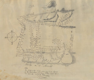
“Within the Diseños Collection there are 493 hand-drawn sketch maps, or diseños, that were created from approximately 1866-1871. These sketch maps were hand-copied from originals that were created from approximately 1827-1846. These are part of a larger collection that makes up the Spanish and Mexican Land Grant Records that also include expedientes, or written documents regarding the grant petition, and other related documents. Each diseño includes naturally occurring boundaries such as rivers, mountains, rock outcropping, and trees as markers. Many of the diseños have labeled neighboring properties and as part of the initial land grant process all boarders were agreed upon by surrounding landowners. The diseños also show existing travel routes, locations of houses and local place names.
“At the end of the Mexican-American War in 1848, California became a territory of the United States after Mexico and the United States signed the Treaty of Guadalupe Hidalgo. Among other things, the treaty directed the U.S. government to honor legitimate land claims of Mexican citizens in the territory. Following California’s statehood in 1850, Congress passed the Land Act of 1851 creating the Board of Land Commissioners. The Board used the diseños, expedientes, U.S. Surveyor General surveys, and other related title documents from landowners to verify individual land ownership and boundaries. Over a period of five years, the Board of Land Commissioners reviewed 813 grant claims, but only approved 553. The Mexican land grant process had a major influence on the development of California land by shaping settlement patterns and land ownership. As some of the earliest maps in California, diseños are essential to understanding the complex system of land ownership in the state today.”
California State Archives: https://www.sos.ca.gov/archives/collections/disenos-collection/