Beginning in 1936, a newly-formed German military mapping agency produced a large number of topographic map series covering all parts of Europe at various scales, as well as much of northern Africa and the Middle East.
This organization started out as a back room department of the German Army General Staff, focused on military contingency mapping. But, given the murderous goals of the Nazi regime, it quickly morphed into something else, a military mapping agency which provided planning tools for the Nazi leadership to wage a war of conquest, marked by atrocities and unspeakable crimes.
Berkeley’s Earth Sciences and Map Library owns 20,000 German topographic sheet maps produced by the German Army General Staff’s mapping agency, the Directorate for War Maps and Surveying [= Abteilung für Kriegskarten- und Vermessungswesen]. The Berkeley Library obtained this historically significant collection by participating in the World War II Captured Maps depository program of the U.S. Army Map Service.
A presentation by Wolfgang Scharfe, a geography professor at the Free University of Berlin, at the International Cartographic Conference in Durban in 2003, sheds light on the history of these military map series published by the Directorate for War Maps and Surveying. Scharfe looked at one particular topographic map series covering Spain, published in 2 editions between 1940 and 1944, Spanien 1:50 000.
German military cartographers mapped Spain at different scales. The Nazis saw Spanish dictator Francisco Franco’s fascist regime as an ally, but Franco wisely remained neutral during World War II. Initially, the German military mapping of Spain can be seen as part of an effort to bring the Franco dictatorship into the Second World War as a German ally. One goal was the capture of the important British base at Gibraltar, at the entrance to the Mediterranean Sea.
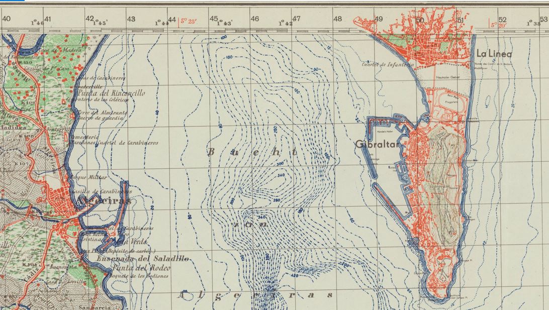
The Bay of Gibraltar, also known as Gibraltar Bay and Bay of Algeciras, identified on the German sheet La Linea-Gibraltar as Bucht von Algeciras. It is located at the southern end of the Iberian Peninsula, near where the Atlantic Ocean and the Mediterranean Sea meet. The sheet is overprinted with the Spanish Lambert Grid, obtained by German military cartographers in an undercover intelligence operation.
The Berkeley Library set of the German Army Map of Spain 1:50,000 consists of 901 sheet maps, accompanied by 3 index maps. It includes two editions of many topographic sheets which cover specific areas of Spain. First Special edition [= Sonderausgabe] sheets were issued between 1940 and 1944, while the second Sonderausgabe sheets were chiefly issued in 1941.
The source map data for the German military maps came from a Spanish map series, the Mapa topográfico de España en escala de 1:50,000 issued by the Direccion general del Instituto Geográfico Catastral y de Estadı́stica.
Scharfe explains that map specialists of the Army Planning Chamber [= Heeresplankammer], the Berlin-based production platform of the Directorate for War Maps and Surveying, copied the Spanish map data. The first edition of this map series (895 published sheets) only contained the Spanish map data. The maps show drainage, roads and trails, railways, vegetation, and other physical and cultural features.
Sheets of the second edition (612 sheets), however, were overprinted with the Spanish Lambert Grid, a geodetic grid which would allow German troops to use the maps to accurately rain down middle and long-range artillery fire on precise locations.
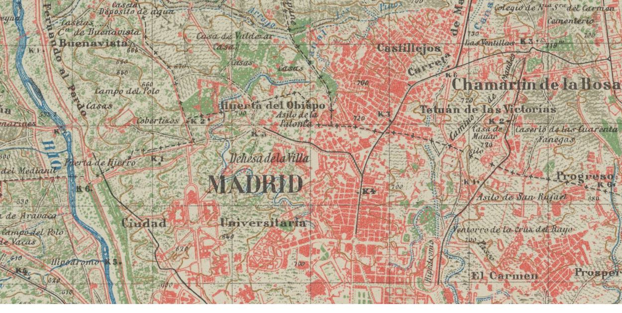
Detail from the Madrid sheet of the German military topographic map series Spanien 1:50 000, published by the Directorate for War Maps and Surveying, a military mapping agency administratively subordinated to the German Army General Staff.
The German military cartographers were able to acquire this secret Spanish military grid data for their own sheets, before that data even appeared on Spanish military maps. This was the result of a German undercover intelligence operation. German agents were able to draw on contacts established when the Nazis aided the fascist Franco dictatorship during the Spanish Civil War (1936-1939) by sending German troops to Spain, the so-called Legion Condor.
But the story does not end there: Scharfe relates that in 1943, irregular Spanish soldiers raided a German Army depot in Nazi-occupied southern France. They removed sheets of the German Army Map of Spain 1:50,000 with the secret Spanish military grid data. Spanish officials started an official inquiry which undoubtedly further undermined trust between the fascist Franco regime and the Nazis. Spanish diplomatic demands for explanations registered in Berlin proved unsuccessful.