In Memoriam: Phil Hoehn (1941-2023)

Phil Hoehn 2
Phil Hoehn, with a Sanborn atlas, Bancroft Library, May 1990. Photograph: Mary-Ellen Jones (BANC PIC 19xx.349).

Longtime UC Berkeley Maps and Earth Sciences Librarian Phil Hoehn passed away on February 6, 2023, from complications of colon cancer. He was 81 years old.

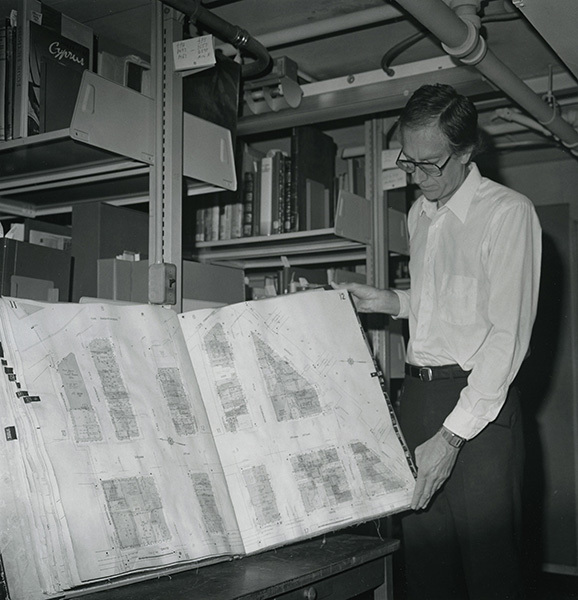
Raymond Philip Hoehn, Jr. was born in Cape Girardeau, Missouri on October 23, 1941, the son of Raymond Philip Hoehn and Florentine Jeanne Hoehn. Following World War II, the Hoehn family moved west to southern California and Phil grew up in Pomona. Inheriting a love of maps from his grandfather, he majored in geography at UCLA. In 1967, Phil earned an MLS from UC Berkeley and began his career as the Map Librarian at UC Berkeley’s Bancroft Library in 1969. He was then asked to assume responsibility for the map collection of the General Library, and managed both collections for several years. When the Map Library was merged with the Earth Sciences map collection, Phil was tapped to lead the new combined unit, eventually known as the Earth Sciences and Map Library, and did so until his retirement in 1996.

Phil counted among his favorite accomplishments at Berkeley the development and management of the California Maps Project, an ambitious effort funded by a grant from the U.S. Department of Education to catalog and re-classify some 21,000 maps held in the collections of UC Berkeley and UCLA. Randal Brandt, currently Head of Cataloging at the Bancroft Library, was the project cataloger. “Phil hired me into my first professional position,” he recalled. “He mentored me, encouraged me, and supported me in the early years of my career. He also taught me how to catalog maps, which has been a part of nearly every job I’ve held since then. I can honestly say that I owe my professional career to Phil.” 

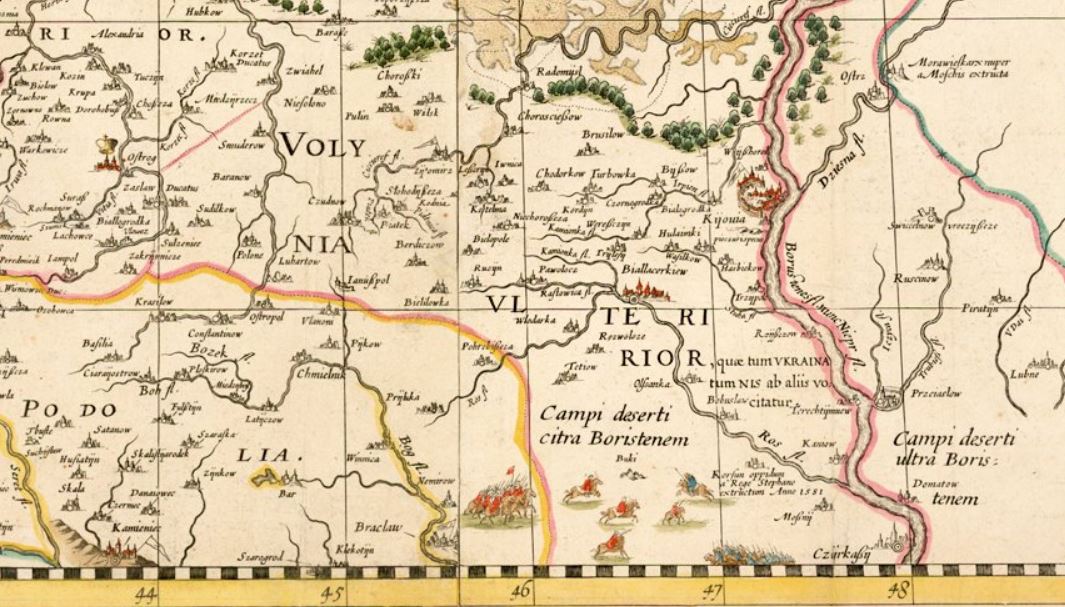
One of the innovative decisions that Phil made during the project was to include geographic location data in records that describe California Land Case Maps. These diseños, rough manuscript maps, were used as evidence in the court cases which determined the validity of Spanish and Mexican land grants once California was ceded to the United States. Without the online tools of today, determining correct longitude and latitude data for the ranchos represented on the land case maps was not a simple task in the early 1990s.  

Although this work was time-consuming, Phil’s decision paid huge dividends several years later when the Bancroft Library undertook the digitization of the maps. When discussing the significance of this metadata, Bancroft Interim Deputy Director Mary Elings, who directed the digitization project, noted the bridge that has been made between the handiwork of 19th century amateur cartographers and contemporary Geographic Information Systems in an important aspect of California history: “Adding the longitude and latitude to the Land Case Map records provided helpful information for researchers in geo-referencing the digitized historic maps, which in turn helps current researchers using GIS systems in their work.”

After he retired from Berkeley, Phil headed down the Peninsula and held the position of map bibliographer at Stanford University’s Branner Earth Sciences Library & Map Collections from 1996 to 2000. At Stanford he performed collection development and maintenance, provided reference assistance, and worked to promote university-wide awareness of the map collections and services. Subsequently, from 2000 until 2007 he served as consulting librarian at the David Rumsey Map Collection (now the David Rumsey Map Center at Stanford), where he created thousands of detailed catalog records for digitized maps. 

Never one to spend much time “retired,” Phil then launched a second career as a volunteer map cataloger, first at the California Genealogical Society and then at the California Historical Society. In 2020, a CHS blog post described Phil’s work: 

In June 2015, Phil Hoehn … took on the daunting task of organizing the California Historical Society’s vast map collection … over 45 drawers of flat sheet maps dating back to at least 1800 (including maps in atlases and books where cartographers depicted California as an island) as well as early mining, railroad, and irrigation maps, bound volumes of Sanborn Fire Insurance maps, and boxes of large rolled maps spanning all the counties in California. During the four years Phil worked reviewing, researching, cataloging, and rehousing the maps he discovered many unique titles, some that appear in only a few other collections in the world.  Many of the works, by such prominent surveyors and cartographers as William Eddy, Herman Ehrenberg, Jasper O’Farrell, and August Chevalier, document the birth and growth of the city of San Francisco … [Phil] leaves nearly 4,000 maps now accessible to researchers. From foldout ones in rare books to enormous rolled maps that practically took a village to bring up from the vaults, Phil has discovered, cataloged, preserved, and documented them all.

Frances Kaplan, until recently Director of Library & Collections at the California Historical Society, expanded on Phil’s impact, saying “It is due to his efforts that the entire map collection at CHS is now cataloged and searchable. Along the way he discovered some rare ones and his work inspired the [current] map exhibit.” The exhibit, “Mapping a Changing California: From the Seventeenth to the Twentieth Century,” is on view through March 11, 2023.

Phil joined the Western Association of Map Libraries (WAML) in 1969, which was just two years after its first meeting took place. Phil was an active member of WAML his entire career. He found that the benefits of WAML membership included getting good practical advice from friendly, experienced colleagues. Phil also emerged as a wheeler and dealer who obtained many great maps for the UC Berkeley Library by participating in WAML duplicate exchanges. He viewed membership as a form of therapy and described WAML meetings as good places to voice local problems and concerns among like-minded individuals. 

Phil had a direct hand in the founding of the California Map Society. Together with Diane M. T. North, who was then a Ph.D candidate at UC Davis, he co-convened a meeting at the Bancroft Library in May 1978, which was the inaugural gathering of the California Map Society. North recalled her long relationship with Phil: “Phil’s knowledge of and deep enthusiasm for maps, all maps, seemed boundless. Anyone privileged to have the opportunity to be guided by him and work alongside him benefited from his professionalism, patience, generosity, and quiet sense of humor.” 

Phil had a longstanding interest in fire insurance maps, including local California maps, produced by the Dakin Publishing Company and he published on the subject. His most important publication, compiled together with William S. Peterson-Hunt and Evelyn L. Woodruff, is a reference tool of enduring value to map librarians and researchers, the Union List of Sanborn Fire Insurance Maps Held by Institutions in the United States and Canada, originally published in 2 volumes by the Western Association of Map Libraries in 1976-1977. The Earth Sciences and Map Library maintains an updated online version on its website which documents Phil’s hard work. 

Together with UCSB map librarian Mary Larsgaard, Phil also co-authored a reference resource which historically has been useful to map librarians, the Dictionary of Abbreviations and Acronyms in Geographic Information Systems, Cartography, and Remote Sensing

Will Murdoch, a book cataloger at the California Historical Society, who worked with Phil from 2015 until 2019, shared his memories of Phil:

He was my mentor and work colleague in the CHS Library.   I cataloged books and Phil processed the maps in that collection.  We shared a lot of fun discoveries with each other and learned about the depth of the CHS archives.  It was an education for me as Phil’s background was extensive and he was so kind to share his knowledge with me.  I miss him and our work together there. 

Phil Hoehn
Phil Hoehn at the California Historical Society, 2020. Photograph: Frances Kaplan.

Phil Hoehn played an important role in building the rich and diverse map collections on the Berkeley campus. As a map librarian, map bibliographer, metadata specialist Phil was instrumental in providing expert resource discovery for cartographic resources at many institutions throughout the Bay Area. More important than his professional qualities, however, Phil excelled as a colleague, mentor, and friend. Everyone who knew him and worked with him was made better for the experience. 


Randal S. Brandt, Bancroft Library

Heiko Mühr, Earth Sciences & Map Library

Susan Powell, Earth Sciences & Map Library


Lines of Latitude: Putting Ukraine on the map (and keeping it there)

In the 16th century, Western European Renaissance cartographers treated the Ukrainian lands as a peripheral place. Initially, Ukraine’s territory appeared only on maps that covered much larger geographical frames, such as Central Europe, Eastern Europe, or the Black Sea region. These early maps still privileged classical sources which had provided descriptions of the area, notably Herodotus, who had authored a detailed account of the Scythian lands north of the Black Sea. Other classical authors, including Ptolemy, Strabo, Pliny the Elder, and Tacitus, covered a later period when the Sarmatians, a confederation of Eastern Iranian nomadic peoples, moved westward and, by 200 BCE, began to dominate the Scythians. Their control of the Pontic Steppe brought the Sarmatians into contact with  Greek and Roman communities.

In 1477, Dominicus de Lapis published the first illustrated edition of Ptolemy’s Geography, translated by the humanist Giacomo d’Angelo da Scarperia, in Bologna, Italy. Its 26 plates, which had been engraved by Taddeo Crevilli of Ferrara, included the map “European Sarmatia,” the first printed map to cover Ukrainian territory. The prestige of Ptolemy’s Geography meant that the sheets showing “European Sarmatia” and “Asian Sarmatia” continued to be standard fare for some time.

Sebastian Münster (1489-1552), Lutheran theologian, Hebrew scholar, mathematician, cartographer, and cosmographer, published four editions of Ptolemy’s Geography in his lifetime. His Geographia universalis vetus et nova (1540), printed in Basel, Switzerland, included “Tabula Europae VIII,” a map of Eastern Europe in trapezoidal form with pictorial relief, essentially Münster’s version of the sheet “European Sarmatia.” All geographical names on this map are drawn from the classical sources which Renaissance scholars prized. Rivers which dissect the Ukrainian lands are thus identified as Tyras (Dniester), Hypanis (southern Bug), Borysthenes (Dnipro or Dnieper), and Tanais (Don).

However, Münster’s 1540 edition of Ptolemy’s Geography did not contain just the Ptolemaic maps. It also featured 21 modern maps, which Münster himself had produced. Münster subsequently added new plates each time he issued a revised edition of his Geographia universalis. The 1552 edition also featured a contemporary map of Poland and Hungary, “Polonia et Ungaria, XX Nova Tabula,” based on information gleaned from the work of the Polish cartographer Bernard Wapowski (ca. 1450-1535).  The Ukrainian lands west of the Dnipro (or Dnieper) River are here identified with regional labels as Russia, Volhinia, Podolia, Codimia, and Bessarabia.

Münster uses the geographical name Russia to identify the westernmost part of Ukraine, the lands of the Ruthenian domain of the Polish Crown, the Ruthenian Voivodeship. Historically this area was part of the territory of the Principality of Galicia-Volhynia (1199-1253) of the Kyivan Rus, and later the historic core of its successor, the Kingdom of Ruthenia (1253-1349). It was subsequently conquered by Lithuanians and Poles. Other Ukrainian lands west of the Dnipro River with Kyovia (= Kyiv) are shown as parts of Lithuania, within its yellow border. By contrast, the lands east of the Dnipro River are identified as Tartaria Precopien (Crimea) and Tartaria Minor, regions controlled by the Crimean Tatars. Moscovia appears in the upper eastern margin of the map, within the green border which demarcates the Tatar sphere of influence. It is shown as a territory which historically paid tribute to the Golden Horde.

Munster Ukraine

The western Ukrainian cities of Leopol (Lviv) and Halitz (Halicz), important medieval centers, are shown in the left margin next to the geographical name Russia. Münster‘s Polonia et Ungaria, XX Nova Tabula thus identifies Russia as the territory of the Kingdom of Poland’s Ruthenian Voivodeship, which existed from 1434 to 1772.

In the right margin appears the emblem of the Golden Horde (also known as Ulug Ulus, literally “Great State” in Turkic), initially the northwestern part of the Mongol Empire, later transformed into a Turkicized khanate. In the 16th century “Tartaria” was controlled by the Crimean Khanate, a successor state of the Golden Horde. This is also a device that enbles Münster to show that the Ukrainian lands were contested borderlands.

In 1618, after the Truce of Deulino, most Ukrainian lands were situated within the Polish-Lithuanian Commonwealth, but social and political crises gradually eroded its power base.  Other powers tried to assert control over parts of the borderlands, including Czarist Russia, the Austrian Habsburgs and the Kingdom of Hungary, the Ottoman Empire, and the Crimean Khanate. Cossack hosts, self-governing groups of Eastern Slavic Orthodox believers, communities with military forces, grew in size, and more aggressively pursued their own interests, notably the Zaporozhian Cossacks, who established the Cossack Hetmanate.

Polish Lithuanian commonwealth
The major subdivisions of the Polish-Lithuanian Commonwealth after the Truce of Deulino, 1618, superimposed on present-day national borders. Shown are the Kingdom of Poland, the Grand Duchy of Lithuania, the Duchy of Livonia, the Duchy of Prussia, and the Duchy of Courland and Semigallia. Image source: Wikipedia.

In 1613, the geographical name “Ukraina” appeared for the first time on a printed map, Magni Ducatus Lithuaniae, caeterarumque regionum illi adiacentium exacta descriptio, in English translation The Grand Duchy of Lithuania and the Surrounding Regions with Their Exact Description.  This celebrated wall map, commonly identified as the Radziwiłł (or Radvila) map, has a complicated publication history: About 1585 Prince Mikołaj Krzysztof Radziwiłł (1549–1616), also known as Mykalojus Kristupas Radvila, a powerful Lithuanian magnate, commissioned Maciej Strubicz (1530-1604), a notable Polish cartographer, to produce a map of the entire Lithuanian state. Radziwiłł saw a need for an accurate map, which could be used as an efficient planning tool for administrative and military matters.  He was also interested in documenting the boundaries and heritage of the old Lithuania, which had been obliterated by the Union of Lublin (1569). The Union’s political settlement had created a single state, the Polish-Lithuanian Commonwealth, both politically and culturally dominated by its Polish core.

Strubicz had served as secretary and geographer to Stephen Báthory, King of Poland and Grand Duke of Lithuania. He had drawn an important military campaign map, which aided Polish and Lithuanian forces in the final stages of the Livonian War (1577-1582), when they faced off against the Muscovite army of Ivan IV “the Terrible.” Báthory managed to force a settlement which excluded the Grand Duchy of Moscow from access to the Baltic Sea.  For his services, Strubicz was subsequently ennobled in Warsaw in 1583. This map covered Livonia, as well as parts of the Grand Duchy of Lithuania and the Grand Duchy of Moscow. An improved version was published in Cologne, Germany, in 1589, by Marcin Kromer under the title Magni Ducatus Lithuaniae, Livoniae et Moscoviae descriptio.

Radziwiłł, who was nicknamed “Sierotka” [the orphan] to distinguish him from other members of the princely Radziwiłł family, served as Great Marshal of Lithuania (1579–1586) and Voivode of Trakai-Vilnius (1604–1616). He was a powerful man with connections and considerable means at his disposal. For years, he funded Strubicz’s work and provided support from others who gathered at Nesvizh Castle, the residential estate of the Radziwiłł family, today located in Niasviž, Belarus.

Strubciz’s diligent efforts greatly improved the mapping of this large section of Eastern Europe. He skillfully mined data derived from inventories, surveys, and terrain measurements. Many of these sources were produced during the Volok reform, a 16th-century land reform which led to an increase in crop yields and state revenue. The Volok reform strengthened the manorial system in Lithuania, but the reforms also reduced many Lithuanian peasants to serfdom. Land holdings were measured, divided into voloks, land units of about 52.8 acres, and entered into a cadaster, a detailed, official record of real estate boundaries, ownerships, and land values of a specific area.

Radziwill Ukraine

Roaming bands of Cossacks and Crimean Tatars are shown at the bottom of the Radziwiłł map of 1613, facing off against each other in the “deserted plains.” Historians like Bohdan S. Kordan, Steven Seegel, and Serhii Plokhy have long emphasized the central role Cossacks played in popularizing the geographical name Ukraine in the 17th century.  Europeans identfied Ukraine as the “Land of the Cossacks.”

The map covers a vast region, stretching from Riga to Smolensk in the north, and from Cracow to Kyiv in the south. It locates 1,020 cities, towns, and villages, and very precisely maps water features throughout this vast region. It shows political and administrative boundaries, including a line which divides the ancient Grand Duchy of Lithuania in half and closely mirrors the present-day Ukrainian-Belarusian border. The region west of Kiova (Kyiv) is identified as “Volynia Ulterior, quae tum Ukraina tum Nis ab aliis volcitatur,” in English translation “Outer Volhynia, known either as Ukraine or as the Dnipro River Region.” The geographical name “Ukraina” thus describes part of the lands in the south, centered on the right bank of the Dnipro River. “Ukraina” roughly extends from Kyiv in the north to Cherkasy in the south. Strubicz identifies an area west of Cherkasy as wild steppe, “Campi deserti citra Boristenem,” in English translation “Deserted plains on this side of the river Borysthenes.”

Also included are historical notes and explanatory text, compiled by Tomasz Makowski (1575–circa 1630), a printer, artist, and engraver, who worked at the court of Prince Radziwiłł at Nesvizh Castle and also played an important role in preparing the map for publication. The English Jesuit mathematician Jacob Bosgrave was also a contributor. The Voivode of Kyiv, the Ruthenian Orthodox magnate Konstanty Wasyl Ostrogski (also known as Prince Kostiantyn Vasyl Ostrozkyi) and Józef Wereszczyński, Catholic bishop of Kyiv, provided cartographic data about the Ukrainian lands.

Prince Radziwiłł now contacted the Dutch map publisher Willem Janszoon (Blaeu) (1571–1638), famous for the manufacture of globes and wall maps, for publication of his map. Hessel Gerritsz (1581–1632), a Dutch cartographer of Blaeu’s publishing house in Amsterdam, engraved the plates, and, in 1613, Blaeu published the wall map in four sheets, under the imprint “Guilhelmus Janssonius.” He also published a related strip map of Ukraine’s Dnipro River region from Cherkasy to its Black Sea estuary on two additional sheets. Following the course of the river, the map describes the Dnipro rapids, local salt mines, towns and villages, and fortifications, and also includes notes about Cossack traditions. Blaeu eventually emerged as a noted publisher of atlases, and featured the Radziwiłł map in his Appendix Theatri A. Ortelii et Atlantis G. Mercatoris, continens tabulas geographicas diversarum Orbis regionum, nunc primum editas cum descriptionibus in 1631. The map subsequently appeared in other atlas editions through 1670.

Beauplan
A decorative cartouche, from the map General Depiction of the Deserted Plains, Commonly Identified as Ukraine, Together with its Neighboring Provinces (Gdansk, Poland, 1648), drawn by Beauplan, who had crisscrossed the territory of the Polish-Lithuanian Commonwealth and the lands of the Cossack Hetmanate on military campaigns against Cossacks and Crimean Tatars and travelled throughout much of what today constitutes Ukraine.

One cartographer who recognized the significance of the Radziwiłł map was Guillaume le Vasseur de Beauplan (1600-1673), a French military engineer, who served for two decades in the army of the Polish-Lithuanian Commonwealth, starting in 1630. Beauplan was initially charged with identifying suitable sites for the construction of fortifications in Ukraine. Later he planned settlements, and built or enlarged fortresses. Beginning in 1648, Beauplan turned his attention to the map trade. He published a general map of Ukraine, in 1650 followed by a special map of the same area on eight sheets, engraved in the workshop of the Dutch cartographer and map publisher Willem Hondius (de Hondt) in Gdansk.

In 1660, the Carte d’Ukranie, contenant plusieurs provinces comprises entre les confins de Moscovie et les limittes de Transilvanie, a Beauplan map published in Rouen, France, by Jacques Cailloue, boldly demarcated the boundaries of Ukraine. That same year Cailloue also published a second, enlarged edition of Beauplan’s popular Description d’Ukranie (Rouen, 1660). A third edition followed in 1661.  In his writings and on his maps Beauplan carefully noted the geographical naming practices of the inhabitants of the Ukrainian lands. His decision to identify the vast region located between Transylvania and Muscovy as Ukraine reflects 17th century Cossack usage.

Beauplan text
Title page of the 1660 edition of Beauplan’s  Description d’Ukranie which provides information on many topics: Cossacks, Crimean Tatars, Polish nobles, serfdom, the country’s flora and fauna, its topography, religious and ethnic customs, governmental institutions, and many of Ukraine’s cities and towns. Image source: Wikipedia.

Beauplan’s maps were subsequently incorporated in Blaeu’s Atlas major (1659-72) and appeared in the 1680s in influential atlases published by Johannes Janssonius and Moses Pitt. Other cartographers now treated Beauplan’s work in Eastern Europe as authoritative, and continued to see Ukraine as “Land of the Cossacks.” For the next century and a half cartographers faithfully reproduced Beauplan’s maps in atlas compilations. Beauplan thus played a crucial role in helping to codify the usage of the geographical name “Ukraine,” for a large defined territory.


Suggested readings:

Buczek, Karol. The History of Polish Cartography from the 15th to the 18th Century. 2nd edition. Amsterdam: Meridian Publishing Company, 1982.

Kordan, Bohdan S. Land of the Cossacks: Antiquarian Maps of Ukraine. Winnipeg: Ukrainian Cultural and Educational Centre, 1987.

Kordan, Bohdan S. The Mapping of Ukraine: European Cartography and Maps of Early Modern Ukraine, 1550-1779. New York: The Ukrainian Museum, 2008.

Magocsi, Paul R. Historical Atlas of Central Europe. 3rd edition. Toronto: University of Toronto Press, 2018.

Plokhy, Serhii. The Gates of Europe: A History of Ukraine. Revised edition. New York: Basic Books, 2021.

Plokhy, Serhii. “Placing Ukraine on the Map of Europe.” In The Frontline: Essays on Ukraine’s Past and Present, 15-36. Cambridge, MA: Harvard Ukrainian Research Institute, 2021.

Seegel, Steven. Ukraine under Western Eyes: The Bohdan and Neonila Krawciw Ucrainica Map Collection. Cambridge, MA: Harvard Ukrainian Research Institute, 2011.


Lines of Latitude: How historic maps tell the story of Ukraine

Please join us for a Maps & More program at the Earth Sciences and Map Library in McCone Hall, located near North Gate on the UC Berkeley campus, on Wednesday, October 26th.

Professor John Connelly (Director, Institute of Slavic, East European, and Eurasian Studies) will introduce a temporary exhibit of historic maps of Ukraine with brief remarks at 12:15 PM and 2:15 PM. Dr. Connelly, a specialist in East European history, currently teaches a course “Ukraine and Its Neighbors.”

Highlights from the library’s collection of Ukrainian, Central European and East European maps and atlases will be on display throughout the afternoon, from noon to 4 PM.

European Renaissance cartographers treated Ukraine as a peripheral place. That changed in the 17th century, in part due to work done by Guillaume le Vasseur de Beauplan (1600-1673), a French military engineer and cartographer, who served for two decades in the army of the Polish-Lithuanian Commonwealth, starting in 1630.

Beauplan was initially charged with identifying suitable sites for the construction of fortifications in Ukraine. Later he planned settlements, and built or enlarged fortresses. Beginning in 1648, Beauplan turned his attention to the map trade. He published a general map of Ukraine, followed by a special map of the same area on eight sheets, engraved in the workshop of the Dutch cartographer and map publisher Willem Hondius (de Hondt) in Gdansk, Poland.

A decorative cartouche, from the map General Depiction of the Deserted Plains, Commonly Identified as Ukraine, Together with its Neighboring Provinces (Gdansk, Poland, 1648), drawn by Beauplan, who had crisscrossed the territory of the Polish-Lithuanian Commonwealth and the lands of the Cossack Hetmanate on military campaigns against Cossacks and Crimean Tatars and travelled throughout much of what today constitutes Ukraine.

In 1660, a Beauplan map published in Rouen, France, by Jacques Cailloue, the Carte d’Ukranie, contenant plusieurs provinces comprises entre les confins de Moscovie et les limittes de Transilvanie, boldly demarcated the boundaries of Ukraine. That same year Cailloue also published a second, enlarged edition of Beauplan’s popular book Description d’Ukranie (Rouen, 1660). A third edition followed in 1661.  In his writings and on his maps Beauplan carefully noted the geographical naming practices of the indigenous inhabitants which he encountered in these borderland areas. His decision to identify the vast region located between Transylvania and Muscovy as Ukraine reflects 17th century Cossack usage.

Maps that Beauplan produced were subsequently incorporated in Johannes Blaeu’s Atlas major (1659-72) and appeared in the 1680s in influential atlases published by Johannes Janssonius and Moses Pitt. Other cartographers now treated Beauplan’s work in Eastern Europe as authoritative and continued to see Ukraine as “Land of the Cossacks.” For the next century and a half other cartographers faithfully reproduced Beauplan’s maps in atlas compilations. Beauplan thus played a crucial role in helping to codify the usage of the geographical name “Ukraine” for a large defined territory.

Most of the maps and atlases in the collections of the Earth Sciences and Map Library cover Ukraine and associated larger frames of geographical reference, like the Black Sea region, Central Europe, or Eastern Europe in the late 19th and 20th centuries. Some were produced by the murderous regimes which sought to dominate Ukraine and its neighbors.

The Kharkiv region, detail from an ethnographic map of the Ukrainian S.S.R. based on the 1926 census of the Soviet Union. That census took place when Ukrainians were still free to express ethnic preferences, before the Stalinist repression, the Holodomor (the Terror-Famine of 1932-1933), and before Nazi Germany invaded the area and murdered millions of Ukrainians during World War II. In 1926, the countryside appears solidly Ukrainian. Most cities have sizable Jewish communities, in particular Kharkiv. Image source: Nationalitätenkarte der Ukraine (Berlin, 1943), from Atlas der Ukraine und benachbarten Gebiete, a loose-leaf atlas published by a Nazi Ostforschung Institute. Digitized by the UC Berkeley Library, as part of its ongoing German World War II Captured Maps digitial humanities project.

And finally, one of the most visually stunning maps in the collections of the Earth Sciences & Map Library:

Detail from Sergei V. Pozniak’s pictorial map The Kiev-Pechersk Lavra (Kyiv, 1994), a perspective view of Kyiv-Pechers’k Dormition Lavra, also known as the Kyiv Monastery of the Caves, founded in 1051, a preeminent center of Eastern Orthodox Christianity.

This event marks a return of the Earth Science & Map Library’s Maps and More Pop Up Exhibit Series.

Open to all audiences.

Event contact: eart@library.berkeley.edu, 510-642-2997

Access Coordinator: Susan Powell, smpowell@berkeley.edu, 510-642-2997


The Man who anchored Ukraine in the West: Mykhailo Hrushevsky and the historical geography of Eastern Europe

Ukrainian 50 hryvnia note
Mykhailo Hrushevsky (1866-1934), historian and leader of the Ukrainian national movement, on a Ukrainian 50 Hryvnia banknote.

I remember sitting in a lecture hall at the University of Hamburg in 1986 during my sophomore year.  Friends had told me to come early and I watched as every single seat gradually filled up. There was a lot of chatter.

A middle-aged man stepped onto the podium, Klaus-Detlev Grothusen, a scholar of Eastern European history. Two graduate assistants set up a record player, unrolled a wall map, left a pile of books on his lectern. Grothusen was a man who loved what he was doing. Within the first 20 minutes of his ”Introduction to East European History” he had already fit in extended passages from Gogol’s Dead Souls and played a recording of a Ukrainian children’s song to illustrate his points. The students were laughing.

Then Grothusen switched gears and put on his analytical hat. The essential building blocks of East European history, he argued, were the histories of the multiethnic empires that had long dominated the region. Grothusen pointed them out on the wall map. He pointed to the Ottoman Empire which controlled much of the Balkans. Then he looked at the center of the map, focused attention on the Polish-Lithuanian Commonwealth. It was surrounded by three dynastic empires, Tsarist Russia, the Austrian Habsburg Empire, and the Kingdom of Prussia, whose leaders would later construct and dominate the German Empire. The wall map illustrated how those three powers carved up the Kingdom of Poland and the Grand Duchy of Lithuania in three partitions in the late eighteenth century (1772, 1793, 1795). Grothusen discussed that in some detail.

In Central and Eastern Europe, nation states were latecomers. Many only appeared on the map after the Balkan Wars (1912-1913) and the end of World War I (1918-1919).  Some of those East European nation states disappeared again, when the Soviet Union revealed its imperial ambitions. In 1986, Grothusen argued that those imperial ambitions were still very much alive.

Front cover of Paul Magosci's Historical Atlas of Central Europe, recently republished in a thrid edition by the University of Washington Press.

Some historical atlases tell this story well. Paul Robert Magocsi, the John Yaremko Chair of Ukrainian Studies at the University of Toronto, authored one of my favorites. The cover illustration of his Historical Atlas of Central Europe , first published in 1993, and now republished in a third edition in 2018 by the University of Toronto Press, gave me pause earlier this week. It shows Central Europe in 1910, on the eve of the Balkan Wars, still dominated by multiethnic empires.

Russian imperial historians, men like Nikolay Karamzin, Sergey Mikhaylovich Solovyov, Vasily Osipovich Klyuchevsky, and Mikhail Petrovich Pogodin, long ago identified the medieval Kyivan Rus’ as the first authentic state of the Eastern Slavs and laid claim to its legacy. The demise of the Kyivan state, they argued, meant that the center of political gravity shifted far to the northeast, away from Kyiv, to the Central Russian Principality of Vladimir-Suzdal. Initially, the rulers of the town of Moscow were just bit players, overshadowed by their more powerful neighbors, first Suzdal, then Vladimir, then Tver. In the 15th century, however, these historians declared, Moscow finally stepped out of the shadows to fulfill its imperial destiny: After the fall of Constantinople in 1453, court scribes proclaimed that the Tsarist autocracy had a valid title to be the successor of the Roman and Byzantine empires. Moscow thus stepped into her new, self-appointed role as the “Third Rome.”

The tsar himself, the embodiment of sovereign authority, stood at the center of Moscow’s autocracy. By the early 18th century, the tsar claimed to be the “Emperor and Autocrat of All the Russias.” And those ”Russias” were carefully enumerated, first and foremost Great Russia (Velikaya Rossiya or Velikorossiya), the territorial core of the Grand Duchy of Moscow; secondly White Russia (Belaya Rossiya), what is still called Belarus today; and finally Little Russia (Malaya Rossiya or Malorossiya), today the independent country of Ukraine.

Vladimir Putin has seized upon this carefully crafted story in his speeches and writings, because it provides a useable national past and seemingly, in his eyes, historical legitimacy for his dangerous and murderous pipedreams of reviving the Russian imperium. According to Putin all Eastern Slavs are essentially Russians, “one people,” a “yedinyi narod.” Fiona Hill eloquently questioned these claims in a recent Politico interview, singling out Putin’s vision of a “Russky Mir” or “Russian World.” Putin and Sergey Lavrov have long argued that Ukraine does not really exist, that its national territory is properly identified as “Novorossiya,” or “New Russia.” Both deny the right to self-determination to Ukrainians.

How do we answer that? Where can we look for an answer? The very idea of what Ukraine represents is wrapped up in another historical narrative, one that was carefully crafted by the leader of the Ukrainian national movement, the historian and statesman Mykhailo Serhiiovych Hrushevsky (1866-1934). As a young scholar, with his published thesis in hand, Hrushevsky was handed a tremendous gift, he was appointed chair of Ukrainian history at Lviv University. This was a newly created position, the very first one of its kind.

Lviv, that great western Ukrainian city, was at that time located in the easternmost reaches of the Habsburg Empire’s province of Galicia. It was the seat of key institutions which spearheaded the Ukrainian cultural revival, the Ukrainian Greek Catholic Church, the Shevchenko Scientific Society, and also the Prosvita society, founded in 1868 and dedicated to spreading literacy and education in the Ukrainian language.

Lviv was about the only place where Ukrainian national aspirations could be publicly voiced at this time and Hrushevsky seized that chance. In 1897 he was elected president of the Shevchenko Scientific Society, and rebuilt it to function as a Ukrainian Academy of Sciences-in-exile, with popular and scholarly journals, a publishing house, a library, and a museum.

As a historian and ethnographer, Hrushevsky reconstructed the story of Ukraine’s past, most notably in his magisterial ten-volume History of Ukraine-Rus’, the first major synthesis of Ukrainian history. The first volume appeared in 1898, the final one was published posthumously, in 1937.  Hrushevsky summarized his key ideas in an article in 1904, “The Traditional Scheme of ‘Rus’ History and the Problem of a Rational Ordering of the History of the Eastern Slavs.” This seminal essay immediately ignited heated debates because Hrushevsky claimed what should have been obvious all along, that the Ukrainians, Belarusians and Russians had distinct identities and histories, which deserved separate historical treatments.

Early medieval kingdoms

The two principalities of Galicia and Volhynia made up the the westernmost part of the Kyivan Rus’ and were united in 1199 by Grand Prince Roman the Great of Kyiv (Source: Magocsi’s Historical Atlas of Central Europe).

Hrushevsky firmly anchored Ukraine’s history in the West: He showed that the Kyivan Rus’, with its distinct political-administrative structure, socio-economic base, culture and laws, was the creation of southern tribes of the Eastern Slavs.  After the disintegration of the Kyivan Rus’, Hrushevsky looked to the southwest and identified a new center of political gravity there. He tied the history of Ukraine to the Principality of Galicia-Volhynia (1199-1253) and the Kingdom of Ruthenia (1253-1349) which emerged out of it. The center of the Ruthenian kingdom, ultimately conquered by Lithuanians and Poles, and absorbed by the Polish-Lithuanian Commonwealth, survived relatively intact as the Ruthenian domain of the Polish Crown, it formed the Ruthenian Voivodeship. Hrushevsky thus tied the history of Ukraine (and likewise the history of Belarus) to the Polish-Lithuanian Commonwealth, and not to the Tsarist autocracy.

Ukrainian People's Republic propaganda postcard
A postcard from the Ukrainian War of Independence (1917-1921) shows Ukrainian volunteers prepared to challenge the double-headed eagle of the Tsarist autocracy.

The unraveling of Tsarist power during the February Revolution, the first stage of the Russian Revolution in 1917, opened new possibilities. The Tsentralna Rada (Ukrainian Central Council) in Kyiv, the All-Ukrainian council (soviet) of the Ukrainian People’s Republic, elected Hrushevsky as chairperson. Under his direction, this body soon became the revolutionary parliament of Ukraine. Hrushevsky joined the newly formed Ukrainian Party of Socialist Revolutionaries, the majority party.  In June 1917, the Ukrainian People’s Republic declared its autonomy and was recognized by the Prime Minister of the Russian Provisional government, Alexander Kerensky. In January 1918, after the Bolsheviks took control in Russia, the Rada proclaimed Ukraine an independent and sovereign state. Three weeks later, the New York Times published excerpts from Hrushevsky’s “Ukraine’s Struggle for Self-Government” and introduced him as “one of the new republic’s most eminent men.” As a radical democrat Hrushevsky successfully opposed a Bolshevik takeover and in April 1918 he was elected president, after the Rada adopted a Ukrainian constitution. But Hrushevsky was soon overthrown in a coup d’état by conservative power brokers. The Ukrainian Bolsheviks decamped for Kharkiv, Ukraine’s second-largest city, and established a rival government there, the Ukrainian Soviet Republic, aided by the bayonets of the Red Army. In the end, the Ukrainian War of Independence (1917-1921) ended disastrously for Ukrainians, their country was divided by Poland and the new Bolshevik regime.

Map of Ukraine, showing the country' proposed borders. Prpared for the Paris Peace Conference at the end of World War I

Map of Ukraine, showing the country’ proposed borders. Prepared for the Paris Peace Conference at the end of World War I, 1918.

The Ukrainian Soviet Socialist Republic, also known as Soviet Ukraine, was one of the constituent republics of the Soviet Union. In 1923, its All-Ukrainian Academy of Sciences elected Hrushevsky as full member and he returned to Kyiv. He held the chair of Modern Ukrainian History and edited the journal Ukraïna from 1924 to 1930, the official publication of the historical section of the All-Ukrainian Academy of Sciences. By 1929, with the power of Stalinist operatives on the rise, attacks on Hrushevsky increased, for not adopting official Soviet Marxist interpretations. He was arrested in March 1931, subjected to constant surveillance, and forced to live in Moscow. Like many other Ukrainian intellectuals, most of his students and co-workers were arrested and repressed. Many subsequently died, murdered by the Stalinist regime.  Hrushevsky himself died in suspicious circumstances, after what should have been minor surgery, in 1934.

I thought of Klaus-Detlev Grothusen several times these last weeks, how his eyes lit up when he played music composed by Tchaikovsky, or when he read poetry from Taras Shevchenko’s Kobzar, one of the seminal works of Ukrainian literature. But I also remember Grothusen’s discussion of the Stalinist system. He quoted Stalin himself, who tried to legitimize his methods by saying darkly that “Russians need a tsar.”

Stalin and Putin share the belief that coercion and autocracy are essential tools in their tool chest. Ukraine, a country that was brutally repressed by Stalin, is now attacked by Putin who seems determined to liquidate its ­independence. Ukraine is a viable nation state, Europe’s second-largest country, with 44 million Ukrainian citizens.  Let’s all help to make sure Ukraine endures and flourishes.