Tag: maps
Announcing the 2016 Calif. Map Society student paper contest
Call for Maps & Papers
to be presented at the California Map Society Meeting
Saturday, June 4, 2016
Koret Auditorium, San Francisco Public Library
100 Larkin Street, San Francisco, CA 94102
Undergraduate and graduate students in geography and related disciplines at UC Berkeley are invited to submit papers on a cartographic topic or original maps for a competition to present at the June 2016 Meeting of the California Map Society (CMS). Finalists will give 15-minute presentations. One winner will receive a cash award of $200 and a certificate, and up to 2 finalists will each receive cash awards of $100 and certificates from the CMS. Additionally, all finalists will receive free registration and meals for the meeting.
The CMS meeting is a one-day event for cartography professionals, faculty, and students in the state to explore emerging trends in cartography and digital mapping, including technology and applications. Students will have the opportunity to meet professionals from academia and industry throughout the day. Please visit the CMS website, www.californiamapsociety.org for future updates of the detailed schedule.
To apply: Submit a digital copy of the attached application and your original work (digital mapping and geo-visualization submissions should be in PDF format and have a resolution of 600 DPI) to the Judging Committee (chair: Susan Powell, smpowell@berkeley.edu) by Monday, April 4, 2016. The California Map Society will notify selected students by Wednesday, April 13, 2016.
For further information, contact Susan Powell at smpowell@berkeley.edu.
Event: Maps & More: Maps and a Movie
 The final Maps and More of the semester is tomorrow, Friday, 12/4 at 11 am in the Earth Sciences and Map Library.
Watch BBC’s “Mapman” as he travels across Britain with the aid of only Bartholomew’s vintage cycling map and a vintage bicycle. Then compare UC Berkeley’s edition of the Bartholomew map to other bicycle touring maps in the collection.
Event: Maps and More: Drought/Deluge

Drought/Deluge
Friday, Nov. 20
11 am – Noon
Earth Sciences & Map Library
50 McCone Hall
Alexander Arroyo and Phil Campanile, two graduate students from the Geography Department are co-curating this month’s exhibit, which ties in with a seminar they are leading this year at the Social Sciences Matrix called “Re-Representing the Earth Through Landscape, Infrastructure, and Data.”
Event: Visualizing History: Mapping the 1915 San Francisco World’s Fair
Join Bancroft Library in celebrating the 100th anniversary of the 1915 San Francisco Panama-Pacific International Exhibition by digitally mapping rarely seen photographs of the world’s fair onto a historic map of the fairgrounds using the Historypin platform.
The event will kick off with a gallery tour by Curator Theresa Salazar of the Bancroft Library’s PPIE exhibit: The Grandeur of a Great Labor: The Building of the Panama Canal and the Panama-Pacific International Exposition, followed by a reception and brief talk in the beautiful Morrison Library.
Participants will then work together to explore archival images of the world’s fair and try to pinpoint the exact locations where the photos were taken. Using maps and guides as you would have 100 years ago, you’ll virtually find your way through “The Zone” and its sometimes-fatal carnival rides, wander through the massive exhibit halls, and marvel at the architecture of the state and country pavilions. History “pinners” will see their results live on the Historypin PPIE site at the event. We guarantee you’ll never see SF’s Marina neighborhood the same way again!
Thursday, November 19, 2015
4:00-4:30 pm – Location: Bancroft Library Gallery
Bancroft Library Gallery Tour with Curator Theresa Salazar – meet in the Bancroft Library lobby (following the gallery tour, participants will be escorted to the Morrison Library for the remainder of the event)
4:30-7:00 pm – Location: Morrison Library
Welcome Reception and Talk by Laura Ackley, author of San Francisco’s Jewel City: The Panama-Pacific International Exposition of 1915.
Demonstration and Pinathon
After a quick tour of the virtual fairgrounds, you’ll have a chance to get hands-on working in groups to help us pin historic images from Bancroft’s collections onto the 1915 fairground map, using clues, fair guides, maps, and more.
Live sharing on Historypin PPIE Site
We will have groups share some of the just-pinned materials Live on the Historypin PPIE site—Tell us what you discovered in your time travels!
Event: Maps and More is back on 10.30.15 with “Ghost Town Maps”

From Death Valley to Zombie Subdivisions, come see the spookiest maps in our collection at the next Maps and More!
Ghost Town Maps
10.30.15
11 am – 12 pm
Earth Sciences & Map Library
50 McCone Hall
Samantha Teplitzky & Susan Powell
Event: Maps of the Moon, and More!

The Earth Sciences & Maps Library is kicking off this year’s “Maps and More” series with:
Maps of the Moon, and More!
9/18/15, 11 am – 12 pm
Earth Sciences & Map Library Seminar and Reading Room
EPS grad student, Heidi Fuqua, will help prepare us for International Observe the Moon Night on 9/19 as she demonstrates how our knowledge of our Moon has grown and changed, highlights the different methods used to obtain information on the Moon, and offers insight into current hot topics in lunar research.
——————
And save the date for future Maps and More:
10/2: Yosemite at 125 with Becky Miller
10/30: Ghost town maps
11/20: Drought or deluge?
12/4: Maps and More movie study break
Primary Sources: The Birmingham Public Library’s Digital Collections
The Department of Archives and Manuscripts of the Birmingham Public Library serves as the archives for the city of Birmingham, Alabama, and for the Episcopal Diocese of Alabama and numerous organizations and other institutions. Their collection includes government records, business records, maps, photographs, letters, diaries, scrapbooks, and other primary source materials.

The Library’s Digital Archives provides access to an increasing number of those materials. The collections can be browsed by subject, by type, or searched.
Just a few items of interest from the collection:
- A scrapbook of articles published from 1913-1967 about the Ku Klux Klan, most of which are from the 1950s and 60s.
- Jemison Magazine, a publication of the Jemison Real Estate and Insurance Company, which developed the cities of Fairfield (Corey) and Mountain Brook as well as building several structures in Birmingham. . The company also built several neighborhoods, hotels, apartments, and office buildings in Birmingham. The serial covers the years 1910-1914 and 1926-1930 and includes photographs, architectural plans, biographies, and articles.
- Early Birmingham newspapers, including Birmingham Iron Age (1874-1885), Weekly Iron Age (1884-1887), Weekly Age (1888-1899), and Pratt City Herald (1899-1901).
- An online exhibit and accompanying book and newspaper articles describing the 1902 tragedy at Shiloh Baptist Church where Booker T. Washington came to speak to the National Baptist Convention. An overcrowded building and panic over suspected fire led to the deaths of 120 people.
- A cartography collection that contains regional and historical maps and atlases from the 16th through 20th centuries.
Event: From Panama to San Francisco: Maps of the Panama Canal and the 1915 Panama-Pacific International Exposition

The Spring 2015 Maps and More sessions kick off Friday, February 20th with, “From Panama to San Francisco: Maps of the Panama Canal and the 1915 Panama-Pacific International Exposition.” As the title implies, we will showcase maps of both San Francisco’s 1915 Panama Pacific Exposition and the Panama Canal itself. You can check out more about the series and the maps included at the Maps and More web guide. Maps and More is a monthly pop-up exhibit drawn from the collections of the Earth Sciences and Map Library.
What: From Panama to San Francisco: Maps of the Panama Canal and the 1915 Panama-Pacific International Exposition
Where: Earth Sciences & Map Library seminar room, 50 McCone Hall
When: Friday, February 20th, 11 am – noon
Event: Antarctic Adventures: the 100th anniversary of Shackleton’s legendary voyage
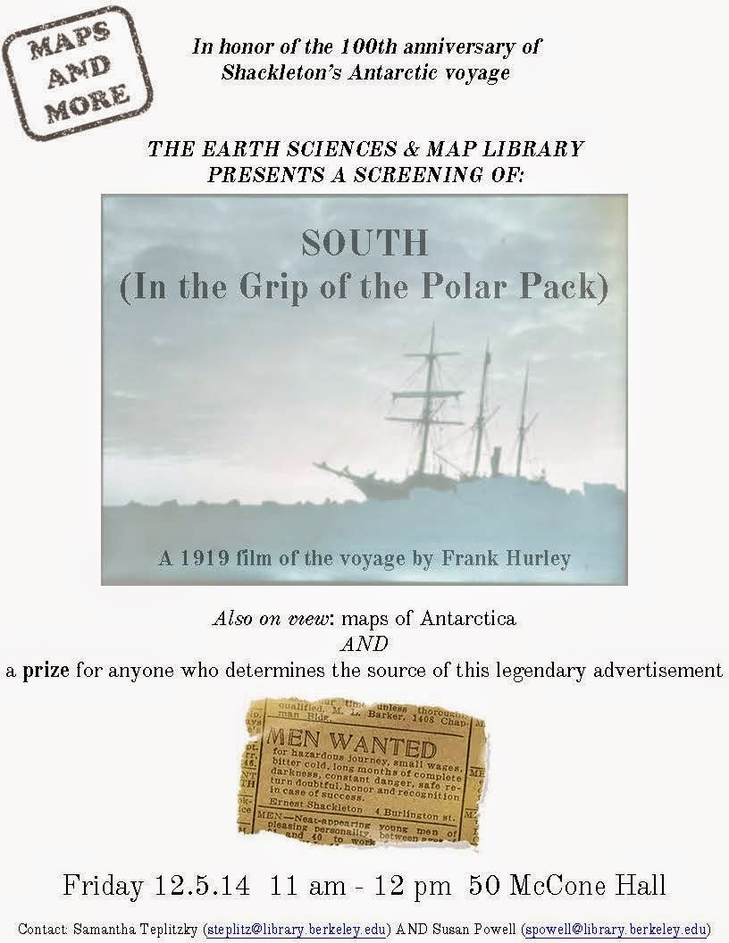
Friday, December 5th, 11 am – 12 pm
Earth Sciences and Map Library Seminar Room
See a screening of the 1919 documentary film of Shackleton’s Endurance Expedition and highlights of Antarctica maps from the collection.
Open to all–