Tag: maps
Coming Soon: Love Your Data, from Editathons to Containers!
UC Berkeley has been loving its data for a long time, and has been part of the international movement which is Love Data Week (LDW) since at least 2016, even during the pandemic! This year is no exception—the UC Berkeley Libraries and our campus partners are offering some fantastic workshops (four of which are led by our very own librarians) as part of the University of California-wide observance.
Love Data Week 2023 is happening next month, February 13-17 (it’s always during the week of Valentine’s Day)!
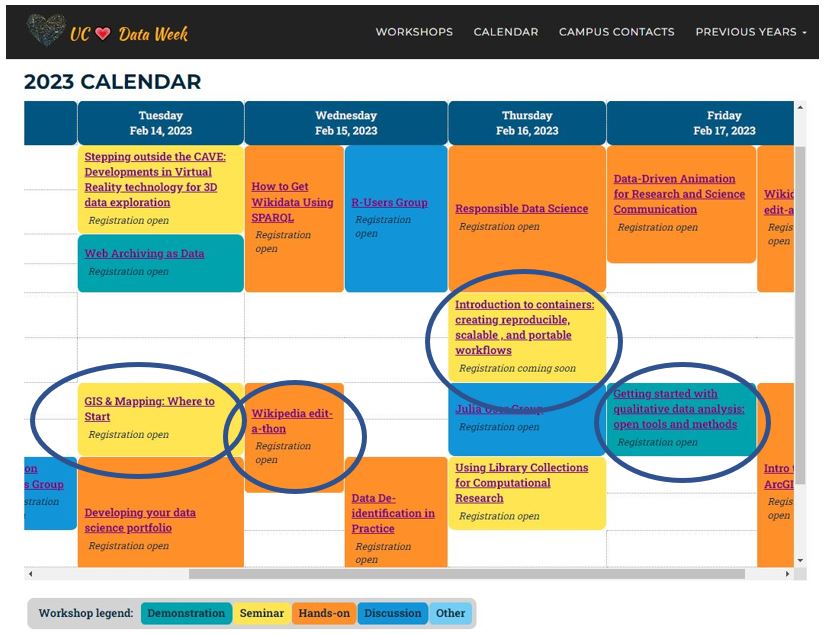
UC Berkeley Love Data Week offerings for 2023 include:
Wikipedia Edit-a-thon (you can also dip into Wikidata at other LDW events)
Textual Analysis with Archival Materials
Getting Started with Qualitative Data Analysis
All members of the UC community are welcome—we hope you will join us! Registration links for our offerings are above, and the full UC-wide calendar is here. If you are interested in learning more about what the library is doing with data, check out our new Data + Digital Scholarship Services page. And, feel free to email us at librarydataservices@berkeley.edu. Looking forward to data bonding next month!
Event: Map the Bay Student Mapmaking Contest for Bay Area students
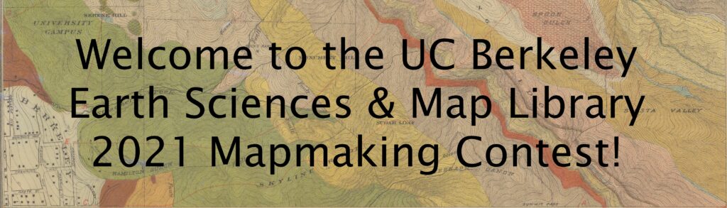
The UC Berkeley Library is hosting our second annual Map the Bay Student Mapmaking Contest for Bay Area students. Online submissions are welcome from March 1, 2021 – April 9, 2021. Maps can be real or imaginary, hand drawn or created on a computer, as long as they have some Bay Area connection. Finalists will be featured in the virtual exhibit, Mapping the Bay. The winning entries (selected through public voting) are eligible for a $50 gift card!
Follow these TWO steps to enter the contest:
-
Fill out the entry form at: http://ucblib.link/map-contest-form
-
Email your map as a jpeg or pdf to: map-contest@berkeley.edu
Find more contest details here: Map the Bay: 2021 Student Mapmaking Contest
View the online exhibit and past entries here: Mapping the Bay
Questions? Email us at: map-contest@berkeley.edu
Susan Powell, On behalf of the UC Berkeley Earth Sciences & Map Library
Trial: Maps and Travel Literature
 Through March 11 the Library has access to the Maps and Travel Literature module of Nineteenth Century Collections Online. You can access it with the proxied link for all NCCO collections and click into the Maps & Travel section or use this link to go directly to the collection.
Primary Sources: Diseños Collection at the California State Archives
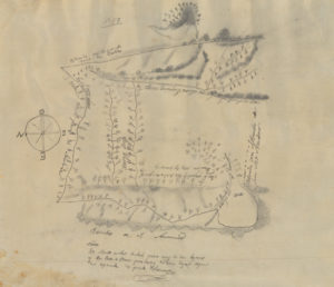
“Within the Diseños Collection there are 493 hand-drawn sketch maps, or diseños, that were created from approximately 1866-1871. These sketch maps were hand-copied from originals that were created from approximately 1827-1846. These are part of a larger collection that makes up the Spanish and Mexican Land Grant Records that also include expedientes, or written documents regarding the grant petition, and other related documents. Each diseño includes naturally occurring boundaries such as rivers, mountains, rock outcropping, and trees as markers. Many of the diseños have labeled neighboring properties and as part of the initial land grant process all boarders were agreed upon by surrounding landowners. The diseños also show existing travel routes, locations of houses and local place names.
“At the end of the Mexican-American War in 1848, California became a territory of the United States after Mexico and the United States signed the Treaty of Guadalupe Hidalgo. Among other things, the treaty directed the U.S. government to honor legitimate land claims of Mexican citizens in the territory. Following California’s statehood in 1850, Congress passed the Land Act of 1851 creating the Board of Land Commissioners. The Board used the diseños, expedientes, U.S. Surveyor General surveys, and other related title documents from landowners to verify individual land ownership and boundaries. Over a period of five years, the Board of Land Commissioners reviewed 813 grant claims, but only approved 553. The Mexican land grant process had a major influence on the development of California land by shaping settlement patterns and land ownership. As some of the earliest maps in California, diseños are essential to understanding the complex system of land ownership in the state today.”
California State Archives: https://www.sos.ca.gov/archives/collections/disenos-collection/
Trial: Fire Insurance Maps Online
 The Library has a trial for Fire Insurance Maps Online (FIMo) through February 28. The trial is set up for access on campus but not via EZProxy so you will need to be on campus or use the VPN to access the resource.
Fire insurance maps were originally created to assist fire insurance companies with assessing their liability in urban areas. They contain detailed information about properties and individual buildings.
Go to https://fims.historicalinfo.com Use the interactive map search or search by place name. During the trial you can search and view historical map coverage throughout the U.S., but will not be able to download full resolution imagery.
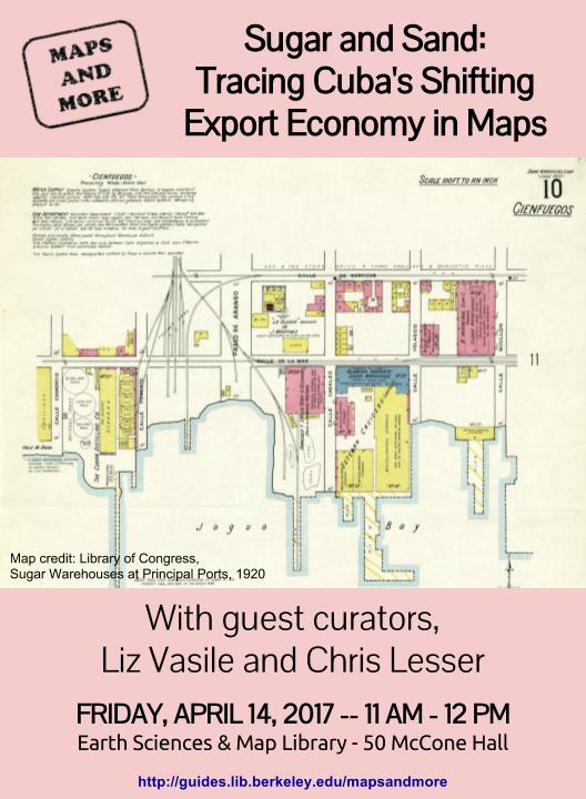
Event- Maps and More: Sugar and Sand: Tracing Cuba’s Shifting Export Economy in Maps
with guest curators Liz Vasile (Center on the Economics and Demography of Aging) and Chris Lesser (Geography)
Friday, April 14, 2017
11 am – 12 pm
Earth Sciences & Map Library
50 McCone Hall
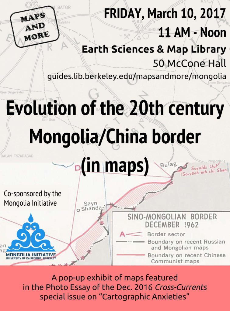
Event: Maps & More: Evolution of the 20th century Mongolia/China border (in maps)
Event: Cartographic Materialities: Mapping the Pre-Modern World (A Symposium)
The Andrew W. Mellon Fellowship of Scholars in Critical Bibliography and the Designated Emphasis in Renaissance and Early Modern Studies Present:
Cartographic Materialities: Mapping the Pre-Modern World (A Symposium)
THURSDAY, MARCH 2
3:30-5:00 – Cartographic Objects Workshop at the Bancroft Library (David Faulds)
Please RSVP to jraisch@berkeley.edu
FRIDAY, MARCH 3
1:15-2:45 – Graduate Student Panel, 308A Doe Library
Keith Budner (Comparative Literature) – “From Geography to Chorography: Representing Pomponius Mela, Ptolemy and Strabo in Two Spanish Renaissance Maps”
Jason Rozumalski (History) – “Kaleidoscopes of Time and Place: Images of places as events in sixteenth-century England”
Grace Harpster (Art History) – “Pastoral Maps: Devotional and Administrative Itineraries in Rural Sixteenth-Century Milan”
Moderator: Diego Pirillo (Italian)
3:00-5:00 – Plenary Panel, 308A Doe Library
Tom Conley (Romance Languages, Harvard) – “Baroque Hydrographies”
Ricardo Padrón (Spanish, UVA) – “The Indies and the Printed Page: Inventing America on the Ramusio Map of 1534”
Valerie Kivelson (History, Michigan) – “An Early Modern Great Game: Maps of Siberia and their Circulation in the 17th and 18th century”
Moderator: Timothy Hampton (French and Comparative Literature)
http://guides.lib.berkeley.edu/cartographic-materialities
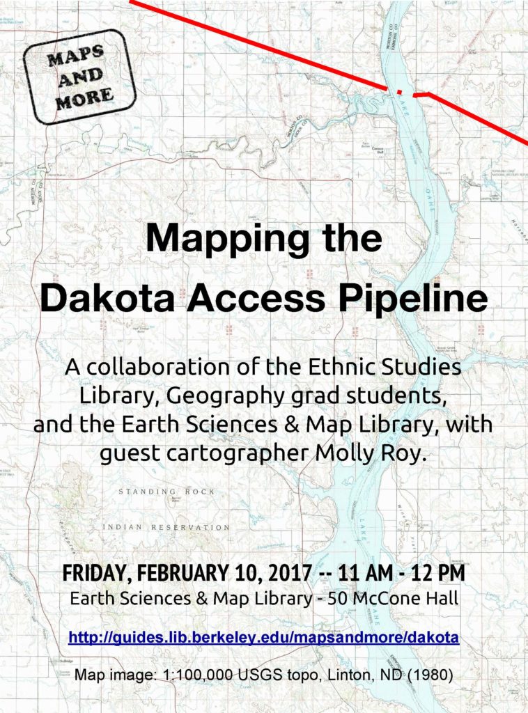
Event: Friday, 2/10 Maps & More: Mapping the Dakota Access Pipeline
The Earth Sciences & Map Library will have its first Maps & More pop-up exhibit of the semester this Friday, February 10, from 11:00 – Noon.
141 Things You Can Learn About Your Community in Just 3 Clicks
Use Community Commons to quickly build a report about any state, county, or group of counties in the USA! Within a minute or so, you will see information on 141 indicators (as of today) including health outcomes, physical environment, clinical care, social and economic factors, and demographics. Use this information for assessment, case-making, advocacy, grant applications, presentations and much more.
Information can be displayed as a table, pie chart, map, or downloaded to Excel.
To get started click here.
Enjoy!